Tanjung Rhu geodata
Tanjung Rhu (Kedah) is a populated place; located in Malaysia in Asia/Kuala_Lumpur (GMT+8) time zone. With population of 1,000 people, there are 172 cities with bigger population in this country. Compared to other cities in Malaysia, 99.4% of cities are located further ↓South; 97.2% of cities are located further →East and 94.4% of cities have higher elevation than Tanjung Rhu. Note1


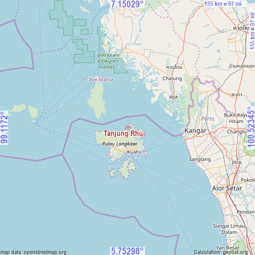
Tanjung Rhu GPS coordinates[2]
6° 27' 7.632" North, 99° 49' 13.152" East
| Map corner | latitude | longitude |
|---|---|---|
| Upper-left | 7.15029°, | 99.1172° |
| Center: | 6.45212°, | 99.82032° |
| Lower-right: | 5.75298°, | 100.52345° |
| Map W x H: | 155.4×155.4 km | = 96.6×96.6mi |
| max Lat: | 6.88732° ⇑0.6% North |
| Tanjung Rhu: | 6.45212° |
| min Lat: | ⇓99.4% South 1.24722° |
| min Long | Tanjung Rhu | max Long |
| 99.68252° | 99.82032° | 118.61119° |
| W 2.8%⇐ | ⇒97.2% E |
Elevation
Elevation of Tanjung Rhu is 5 m = 16 ft, and this is 39.7 m = 130 ft below average elevation for this country.
| Max E: |
1488 m = 4882 ft | 94.4% |
| Avg. | 44.7 m = 147 ft | |
| Tanjung Rhu | 5 m = 16 ft | |
Min E: |
0 m = 0 ft | 5.6% |
See also: Malaysia elevation on elevation.city.
Geographical zone
Tanjung Rhu is located in North Torrid zone (between Equator and Tropic of Cancer). Distance of Equator is 717.4 km =445.8 mi to South.| Distance of | km | miles | from Tanjung Rhu |
|---|---|---|---|
| North Pole | 9289.7 | 5772.4 | to North |
| Arctic Circle | 6683.8 | 4153.1 | to North |
| Tropic Cancer | 1888.5 | 1173.5 | to North |
| Equator | 717.4 | 445.8 | to South |


Nearby cities:
15 places around Tanjung Rhu: (largest is in red/bold)
• Alor Setar
70.1 km =43.6 mi,  121°
121°
• Ayer Hangat
3.5 km =2.2 mi,  176°
176°
• Bedong
110.8 km =68.8 mi,  136°
136°
• Gurun
101 km =62.8 mi,  134°
134°
• Jitra
69.5 km =43.2 mi,  107°
107°
• Kampung Bukit Hantu
10.8 km =6.7 mi,  202°
202°
• Kampung Kilim
6.1 km =3.8 mi,  147°
147°
• Kampung Kok
17.9 km =11.1 mi,  238°
238°
• Kangar
41.8 km =26 mi,  91°
91°
• Kuah
14.2 km =8.8 mi,  169°
169°
• Kuala Kedah
65.9 km =40.9 mi, 126°
• Kuala Perlis
35.1 km =21.8 mi,  99°
99°
• Kuala Teriang
15.2 km =9.4 mi,  229°
229°
• Padang Mat Sirat
14.5 km =9 mi,  221°
221°
• Pantai Cenang
20.4 km =12.7 mi,  210°
210°
Sources, notices
• [Note1] Compared only with cities in Malaysia existing in our database
• [Src1] Map data: © OpenStreetMap contributors (CC-BY-SA)
• [Src2] Other city data from geonames.org with taken over terms of usage.
• [Src3] Geographical zone / Annual Mean Temperature by Robert A. Rohde @ Wikipedia
