Oranjemund geodata
Oranjemund (Karas) is a populated place; located in Namibia in Africa/Windhoek (GMT+2) time zone. With population of 8,496 people, there are 22 cities with bigger population in this country. Compared to other cities in Namibia, 100% of cities are located further ↑North; 54.5% of cities are located further →East and 90.9% of cities have higher elevation than Oranjemund. Note1


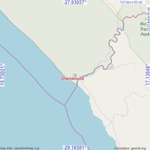
Oranjemund GPS coordinates[2]
28° 33' 0" South, 16° 25' 59.988" East
| Map corner | latitude | longitude |
|---|---|---|
| Upper-left | -27.93057°, | 15.73021° |
| Center: | -28.55°, | 16.43333° |
| Lower-right: | -29.16581°, | 17.13646° |
| Map W x H: | 137.3×137.3 km | = 85.3×85.3mi |
| max Lat: | -17.4° ⇑100% North |
| Oranjemund: | -28.55° |
| min Lat: | ⇓0% South -28.55° |
| min Long | Oranjemund | max Long |
| 13.83998° | 16.43333° | 24.26667° |
| W 45.5%⇐ | ⇒54.5% E |
Elevation
Elevation of Oranjemund is 27 m = 89 ft, and this is 1000.8 m = 3283 ft below average elevation for this country.
| Max E: |
1656 m = 5433 ft | 90.9% |
| Avg. | 1027.8 m = 3372 ft | |
| Oranjemund | 27 m = 89 ft | |
Min E: |
1 m = 3 ft | 9.1% |
See also: Namibia elevation on elevation.city.
Geographical zone
Oranjemund is located in South temperate zone (between Tropic of Capricorn and the Antarctic Circle). Distance of this Southern Tropic circle is 568.5 km =353.2 mi to North.| Distance of | km | miles | from Oranjemund |
|---|---|---|---|
| Equator | 3174.5 | 1972.5 | to North |
| Tropic Capricorn | 568.5 | 353.2 | to North |
| Antarctic Circle | 4226.7 | 2626.3 | to South |
| South Pole | 6832.6 | 4245.6 | to South |


Nearby cities:
7 places around Oranjemund: (largest is in red/bold)
• Bethanie
240.4 km =149.4 mi,  17°
17°
• Karasburg
234.5 km =145.7 mi,  75°
75°
• Keetmanshoop
275.5 km =171.2 mi,  37°
37°
• Lüderitz
246.2 km =153 mi,  329°
329°
• Maltahöhe
416.8 km =259 mi,  7°
7°
• Tses
334.5 km =207.8 mi,  27°
27°
• Warmbad
225 km =139.8 mi,  87°
87°
Sources, notices
• [Note1] Compared only with cities in Namibia existing in our database
• [Src1] Map data: © OpenStreetMap contributors (CC-BY-SA)
• [Src2] Other city data from geonames.org with taken over terms of usage.
• [Src3] Geographical zone / Annual Mean Temperature by Robert A. Rohde @ Wikipedia
