Tses geodata
Tses (Karas) is a populated place; located in Namibia in Africa/Windhoek (GMT+2) time zone. With population of 2,000 people, there are 41 cities with bigger population in this country. Compared to other cities in Namibia, 86.4% of cities are located further ↑North; 75% of cities are located further ←West and 79.5% of cities have higher elevation than Tses. Note1


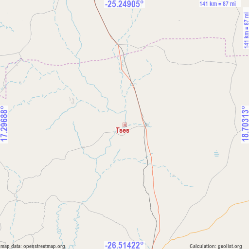
Tses GPS coordinates[2]
25° 52' 59.988" South, 18° 0' 0" East
| Map corner | latitude | longitude |
|---|---|---|
| Upper-left | -25.24905°, | 17.29688° |
| Center: | -25.88333°, | 18° |
| Lower-right: | -26.51422°, | 18.70313° |
| Map W x H: | 140.7×140.7 km | = 87.4×87.4mi |
| max Lat: | -17.4° ⇑86.4% North |
| Tses: | -25.88333° |
| min Lat: | ⇓13.6% South -28.55° |
| min Long | Tses | max Long |
| 13.83998° | 18° | 24.26667° |
| W 75%⇐ | ⇒25% E |
Elevation
Elevation of Tses is 932 m = 3058 ft, and this is 95.8 m = 314 ft below average elevation for this country.
| Max E: |
1656 m = 5433 ft | 79.5% |
| Avg. | 1027.8 m = 3372 ft | |
| Tses | 932 m = 3058 ft | |
Min E: |
1 m = 3 ft | 20.5% |
See also: Namibia elevation on elevation.city.
Geographical zone
Tses is located in South temperate zone (between Tropic of Capricorn and the Antarctic Circle). Distance of this Southern Tropic circle is 272 km =169 mi to North.| Distance of | km | miles | from Tses |
|---|---|---|---|
| Equator | 2878 | 1788.3 | to North |
| Tropic Capricorn | 272 | 169 | to North |
| Antarctic Circle | 4523.2 | 2810.6 | to South |
| South Pole | 7129.1 | 4429.8 | to South |


Nearby cities:
15 places around Tses: (largest is in red/bold)
• Aranos
224.8 km =139.7 mi,  30°
30°
• Bethanie
107.9 km =67 mi,  231°
231°
• Gobabis
394.1 km =244.9 mi,  14°
14°
• Hoachanas
218.7 km =135.9 mi,  1°
1°
• Karasburg
248.6 km =154.5 mi,  162°
162°
• Katutura
385.6 km =239.6 mi,  345°
345°
• Keetmanshoop
79 km =49.1 mi,  170°
170°
• Lüderitz
296.2 km =184.1 mi,  253°
253°
• Maltahöhe
155.1 km =96.4 mi,  318°
318°
• Mariental
139 km =86.4 mi,  358°
358°
• Oranjemund
334.5 km =207.8 mi,  207°
207°
• Otjimbingwe
436.1 km =271 mi,  334°
334°
• Rehoboth
299.8 km =186.3 mi,  342°
342°
• Warmbad
294.5 km =183 mi, 165°
• Windhoek
381.1 km =236.8 mi, 345°
Sources, notices
• [Note1] Compared only with cities in Namibia existing in our database
• [Src1] Map data: © OpenStreetMap contributors (CC-BY-SA)
• [Src2] Other city data from geonames.org with taken over terms of usage.
• [Src3] Geographical zone / Annual Mean Temperature by Robert A. Rohde @ Wikipedia
