Maltahöhe geodata
Maltahöhe (Hardap) is a populated place; located in Namibia in Africa/Windhoek (GMT+2) time zone. With population of 2,329 people, there are 40 cities with bigger population in this country. Compared to other cities in Namibia, 84.1% of cities are located further ↑North; 54.5% of cities are located further ←West and 84.1% of cities have lower elevation than Maltahöhe. Note1


Maltahöhe GPS coordinates[2]
24° 49' 59.988" South, 16° 58' 59.988" East
| Map corner | latitude | longitude |
|---|---|---|
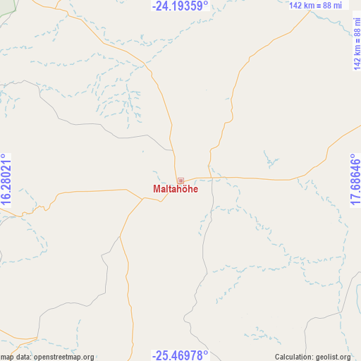
| Upper-left | -24.19359°, | 16.28021° |
| Center: | -24.83333°, | 16.98333° |
| Lower-right: | -25.46978°, | 17.68646° |
| Map W x H: | 141.9×141.9 km | = 88.2×88.2mi |
| max Lat: | -17.4° ⇑84.1% North |
| Maltahöhe: | -24.83333° |
| min Lat: | ⇓15.9% South -28.55° |
| min Long | Maltahöhe | max Long |
| 13.83998° | 16.98333° | 24.26667° |
| W 54.5%⇐ | ⇒45.5% E |
Elevation
Elevation of Maltahöhe is 1348 m = 4423 ft, and this is 320.2 m = 1051 ft above average elevation for this country.
| Max E: |
1656 m = 5433 ft | 15.9% |
| Maltahöhe | 1348 m 4423 ft | |
| Avg. | 1027.8 m = 3372 ft | |
Min E: |
1 m = 3 ft | 84.1% |
See also: Namibia elevation on elevation.city.
Geographical zone
Maltahöhe is located in South temperate zone (between Tropic of Capricorn and the Antarctic Circle). Distance of this Southern Tropic circle is 155.3 km =96.5 mi to North.| Distance of | km | miles | from Maltahöhe |
|---|---|---|---|
| Equator | 2761.2 | 1715.7 | to North |
| Tropic Capricorn | 155.3 | 96.5 | to North |
| Antarctic Circle | 4640 | 2883.2 | to South |
| South Pole | 7245.9 | 4502.4 | to South |


Nearby cities:
15 places around Maltahöhe: (largest is in red/bold)
• Arandis
338.2 km =210.1 mi,  322°
322°
• Aranos
229.5 km =142.6 mi,  70°
70°
• Bethanie
184.2 km =114.5 mi,  174°
174°
• Gobabis
333.2 km =207 mi,  37°
37°
• Hoachanas
148.5 km =92.3 mi,  46°
46°
• Katutura
257 km =159.7 mi,  1°
1°
• Keetmanshoop
226.1 km =140.5 mi,  149°
149°
• Lüderitz
272.6 km =169.4 mi,  222°
222°
• Mariental
101.8 km =63.3 mi,  77°
77°
• Okahandja
317 km =197 mi,  358°
358°
• Otjimbingwe
289.4 km =179.8 mi,  342°
342°
• Rehoboth
168.9 km =104.9 mi, 3°
• Tses
155.1 km =96.4 mi,  138°
138°
• Walvis Bay
327 km =203.2 mi,  309°
309°
• Windhoek
253 km =157.2 mi, 2°
Sources, notices
• [Note1] Compared only with cities in Namibia existing in our database
• [Src1] Map data: © OpenStreetMap contributors (CC-BY-SA)
• [Src2] Other city data from geonames.org with taken over terms of usage.
• [Src3] Geographical zone / Annual Mean Temperature by Robert A. Rohde @ Wikipedia
