Karasburg geodata
Karasburg (Karas) is a populated place; located in Namibia in Africa/Windhoek (GMT+2) time zone. With population of 6,054 people, there are 28 cities with bigger population in this country. Compared to other cities in Namibia, 95.5% of cities are located further ↑North; 88.6% of cities are located further ←West and 65.9% of cities have higher elevation than Karasburg. Note1


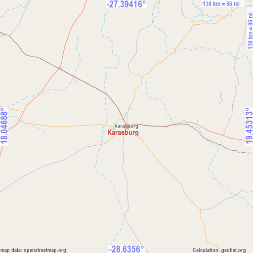
Karasburg GPS coordinates[2]
28° 1' 0.012" South, 18° 45' 0" East
| Map corner | latitude | longitude |
|---|---|---|
| Upper-left | -27.39416°, | 18.04688° |
| Center: | -28.01667°, | 18.75° |
| Lower-right: | -28.6356°, | 19.45313° |
| Map W x H: | 138×138 km | = 85.7×85.7mi |
| max Lat: | -17.4° ⇑95.5% North |
| Karasburg: | -28.01667° |
| min Lat: | ⇓4.5% South -28.55° |
| min Long | Karasburg | max Long |
| 13.83998° | 18.75° | 24.26667° |
| W 88.6%⇐ | ⇒11.4% E |
Elevation
Elevation of Karasburg is 1017 m = 3337 ft, and this is 10.8 m = 35 ft below average elevation for this country.
| Max E: |
1656 m = 5433 ft | 65.9% |
| Avg. | 1027.8 m = 3372 ft | |
| Karasburg | 1017 m = 3337 ft | |
Min E: |
1 m = 3 ft | 34.1% |
See also: Namibia elevation on elevation.city.
Geographical zone
Karasburg is located in South temperate zone (between Tropic of Capricorn and the Antarctic Circle). Distance of this Southern Tropic circle is 509.2 km =316.4 mi to North.| Distance of | km | miles | from Karasburg |
|---|---|---|---|
| Equator | 3115.2 | 1935.7 | to North |
| Tropic Capricorn | 509.2 | 316.4 | to North |
| Antarctic Circle | 4286 | 2663.2 | to South |
| South Pole | 6891.9 | 4282.4 | to South |


Nearby cities:
9 places around Karasburg: (largest is in red/bold)
• Aranos
433.3 km =269.2 mi,  4°
4°
• Bethanie
232.5 km =144.5 mi,  317°
317°
• Keetmanshoop
170.6 km =106 mi,  339°
339°
• Lüderitz
386.4 km =240.1 mi,  293°
293°
• Maltahöhe
395.2 km =245.6 mi,  333°
333°
• Mariental
384.2 km =238.7 mi,  348°
348°
• Oranjemund
234.5 km =145.7 mi,  255°
255°
• Tses
248.6 km =154.5 mi, 342°
• Warmbad
48.2 km =30 mi,  181°
181°
Sources, notices
• [Note1] Compared only with cities in Namibia existing in our database
• [Src1] Map data: © OpenStreetMap contributors (CC-BY-SA)
• [Src2] Other city data from geonames.org with taken over terms of usage.
• [Src3] Geographical zone / Annual Mean Temperature by Robert A. Rohde @ Wikipedia
