Wé geodata
Wé (Loyalty Islands) is a seat of a first-order administrative division; located in New Caledonia in Pacific/Noumea (GMT+11) time zone. With population of 10,375 people, there are 4 cities with bigger population in this country. Compared to other cities in New Caledonia, 70% of cities are located further ↓South; 93.3% of cities are located further ←West and 80% of cities have higher elevation than Wé. Note1


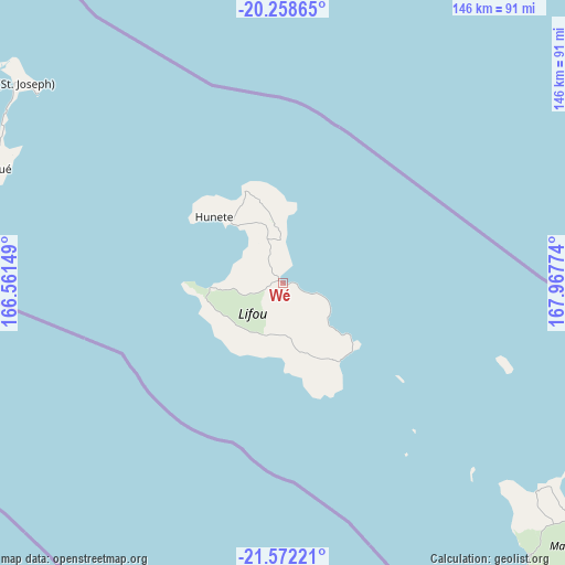
Wé GPS coordinates[2]
20° 55' 0.732" South, 167° 15' 52.596" East
| Map corner | latitude | longitude |
|---|---|---|
| Upper-left | -20.25865°, | 166.56149° |
| Center: | -20.91687°, | 167.26461° |
| Lower-right: | -21.57221°, | 167.96774° |
| Map W x H: | 146.1×146.1 km | = 90.8×90.8mi |
| max Lat: | -19.71161° ⇑30% North |
| Wé: | -20.91687° |
| min Lat: | ⇓70% South -22.66645° |
| min Long | Wé | max Long |
| 163.64702° | 167.26461° | 167.88019° |
| W 93.3%⇐ | ⇒6.7% E |
Elevation
Elevation of Wé is 9 m = 30 ft, and this is 34.3 m = 113 ft below average elevation for this country.
| Max E: |
275 m = 902 ft | 80% |
| Avg. | 43.3 m = 142 ft | |
| Wé | 9 m = 30 ft | |
Min E: |
1 m = 3 ft | 20% |
See also: New Caledonia elevation on elevation.city.
Geographical zone
Wé is located in South Torrid zone (between Equator and Tropic of Capricorn). Distance of this Southern Tropic circle is 280.2 km =174.1 mi to South.| Distance of | km | miles | from Wé |
|---|---|---|---|
| Equator | 2325.7 | 1445.1 | to North |
| Tropic Capricorn | 280.2 | 174.1 | to South |
| Antarctic Circle | 5075.4 | 3153.7 | to South |
| South Pole | 7681.3 | 4772.9 | to South |


Nearby cities:
15 places around Wé: (largest is in red/bold)
• Bouloupari
163.8 km =101.8 mi,  230°
230°
• Canala
152.5 km =94.8 mi,  243°
243°
• Dumbéa
161.3 km =100.2 mi,  211°
211°
• Fayaoué
81.2 km =50.5 mi,  291°
291°
• Houaïlou
175.7 km =109.2 mi,  256°
256°
• La Foa
173.1 km =107.6 mi, 239°
• Moindou
185.5 km =115.3 mi, 242°
• Mont-Dore
166.1 km =103.2 mi, 205°
• Nouméa
172.9 km =107.4 mi, 209°
• Païta
164.4 km =102.2 mi, 214°
• Ponérihouen
194.4 km =120.8 mi, 264°
• Sarraméa
167.7 km =104.2 mi, 240°
• Tadine
94.8 km =58.9 mi,  137°
137°
• Thio
133.6 km =83 mi, 234°
• Yaté-Barrage
142.7 km =88.7 mi,  196°
196°
Sources, notices
• [Note1] Compared only with cities in New Caledonia existing in our database
• [Src1] Map data: © OpenStreetMap contributors (CC-BY-SA)
• [Src2] Other city data from geonames.org with taken over terms of usage.
• [Src3] Geographical zone / Annual Mean Temperature by Robert A. Rohde @ Wikipedia
