Tadine geodata
Tadine (Loyalty Islands) is a populated place; located in New Caledonia in Pacific/Noumea (GMT+11) time zone. With population of 7,492 people, there are 5 cities with bigger population in this country. Compared to other cities in New Caledonia, 60% of cities are located further ↑North; 100% of cities are located further ←West and 63.3% of cities have lower elevation than Tadine. Note1


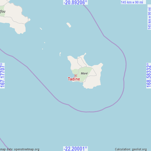
Tadine GPS coordinates[2]
21° 32' 51.036" South, 167° 52' 48.684" East
| Map corner | latitude | longitude |
|---|---|---|
| Upper-left | -20.89206°, | 167.17707° |
| Center: | -21.54751°, | 167.88019° |
| Lower-right: | -22.20001°, | 168.58332° |
| Map W x H: | 145.4×145.4 km | = 90.3×90.3mi |
| max Lat: | -19.71161° ⇑60% North |
| Tadine: | -21.54751° |
| min Lat: | ⇓40% South -22.66645° |
| min Long | Tadine | max Long |
| 163.64702° | 167.88019° | 167.88019° |
| W 100%⇐ | ⇒0% E |
Elevation
Elevation of Tadine is 15 m = 49 ft, and this is 28.3 m = 93 ft below average elevation for this country.
| Max E: |
275 m = 902 ft | 36.7% |
| Avg. | 43.3 m = 142 ft | |
| Tadine | 15 m = 49 ft | |
Min E: |
1 m = 3 ft | 63.3% |
See also: New Caledonia elevation on elevation.city.
Geographical zone
Tadine is located in South Torrid zone (between Equator and Tropic of Capricorn). Distance of this Southern Tropic circle is 210.1 km =130.6 mi to South.| Distance of | km | miles | from Tadine |
|---|---|---|---|
| Equator | 2395.9 | 1488.7 | to North |
| Tropic Capricorn | 210.1 | 130.6 | to South |
| Antarctic Circle | 5005.3 | 3110.1 | to South |
| South Pole | 7611.2 | 4729.4 | to South |


Nearby cities:
15 places around Tadine: (largest is in red/bold)
• Bouloupari
192.2 km =119.4 mi,  259°
259°
• Canala
199.6 km =124 mi,  270°
270°
• Dumbéa
161.8 km =100.5 mi,  245°
245°
• Fayaoué
171.2 km =106.4 mi,  305°
305°
• Houaïlou
236.1 km =146.7 mi,  277°
277°
• La Foa
212.9 km =132.3 mi, 265°
• Moindou
227.7 km =141.5 mi, 265°
• Mont-Dore
157.1 km =97.6 mi,  239°
239°
• Nouméa
168.3 km =104.6 mi, 241°
• Païta
170.1 km =105.7 mi, 247°
• Sarraméa
210.2 km =130.6 mi, 266°
• Thio
172.2 km =107 mi, 267°
• Vao
130.5 km =81.1 mi,  197°
197°
• Wé
94.8 km =58.9 mi,  317°
317°
• Yaté-Barrage
122.8 km =76.3 mi, 236°
Sources, notices
• [Note1] Compared only with cities in New Caledonia existing in our database
• [Src1] Map data: © OpenStreetMap contributors (CC-BY-SA)
• [Src2] Other city data from geonames.org with taken over terms of usage.
• [Src3] Geographical zone / Annual Mean Temperature by Robert A. Rohde @ Wikipedia
