Ponérihouen geodata
Ponérihouen (North Province) is a populated place; located in New Caledonia in Pacific/Noumea (GMT+11) time zone. With population of 2,739 people, there are 15 cities with bigger population in this country. Compared to other cities in New Caledonia, 56.7% of cities are located further ↓South; 56.7% of cities are located further →East and 66.7% of cities have lower elevation than Ponérihouen. Note1


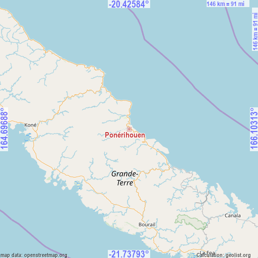
Ponérihouen GPS coordinates[2]
21° 4' 59.988" South, 165° 24' 0" East
| Map corner | latitude | longitude |
|---|---|---|
| Upper-left | -20.42584°, | 164.69688° |
| Center: | -21.08333°, | 165.4° |
| Lower-right: | -21.73793°, | 166.10313° |
| Map W x H: | 145.9×145.9 km | = 90.7×90.7mi |
| max Lat: | -19.71161° ⇑43.3% North |
| Ponérihouen: | -21.08333° |
| min Lat: | ⇓56.7% South -22.66645° |
| min Long | Ponérihouen | max Long |
| 163.64702° | 165.4° | 167.88019° |
| W 43.3%⇐ | ⇒56.7% E |
Elevation
Elevation of Ponérihouen is 19 m = 62 ft, and this is 24.3 m = 80 ft below average elevation for this country.
| Max E: |
275 m = 902 ft | 33.3% |
| Avg. | 43.3 m = 142 ft | |
| Ponérihouen | 19 m = 62 ft | |
Min E: |
1 m = 3 ft | 66.7% |
See also: New Caledonia elevation on elevation.city.
Geographical zone
Ponérihouen is located in South Torrid zone (between Equator and Tropic of Capricorn). Distance of this Southern Tropic circle is 261.7 km =162.6 mi to South.| Distance of | km | miles | from Ponérihouen |
|---|---|---|---|
| Equator | 2344.2 | 1456.6 | to North |
| Tropic Capricorn | 261.7 | 162.6 | to South |
| Antarctic Circle | 5056.9 | 3142.2 | to South |
| South Pole | 7662.8 | 4761.4 | to South |


Nearby cities:
15 places around Ponérihouen: (largest is in red/bold)
• Bouloupari
109.7 km =68.2 mi,  142°
142°
• Bourail
54.7 km =34 mi,  169°
169°
• Canala
75.8 km =47.1 mi,  131°
131°
• Hienghène
65.8 km =40.9 mi,  312°
312°
• Houaïlou
31.6 km =19.6 mi, 134°
• Koné
55.5 km =34.5 mi,  272°
272°
• La Foa
82.6 km =51.3 mi,  147°
147°
• Moindou
74.6 km =46.4 mi,  156°
156°
• Poindimié
18.1 km =11.2 mi,  337°
337°
• Pouembout
52.2 km =32.4 mi,  263°
263°
• Poya
39.4 km =24.5 mi,  221°
221°
• Sarraméa
78.4 km =48.7 mi, 143°
• Thio
103.3 km =64.2 mi, 125°
• Touho
36.1 km =22.4 mi,  334°
334°
• Voh
73.8 km =45.9 mi,  280°
280°
Sources, notices
• [Note1] Compared only with cities in New Caledonia existing in our database
• [Src1] Map data: © OpenStreetMap contributors (CC-BY-SA)
• [Src2] Other city data from geonames.org with taken over terms of usage.
• [Src3] Geographical zone / Annual Mean Temperature by Robert A. Rohde @ Wikipedia
