Maïné Soroa geodata
Maïné Soroa (Diffa) is a seat of a second-order administrative division; located in Niger in Africa/Niamey (GMT+1) time zone. With population of 10,699 people, there are 29 cities with bigger population in this country. Compared to other cities in Niger, 88.4% of cities are located further ↑North; 93% of cities are located further ←West and 55.8% of cities have higher elevation than Maïné Soroa. Note1


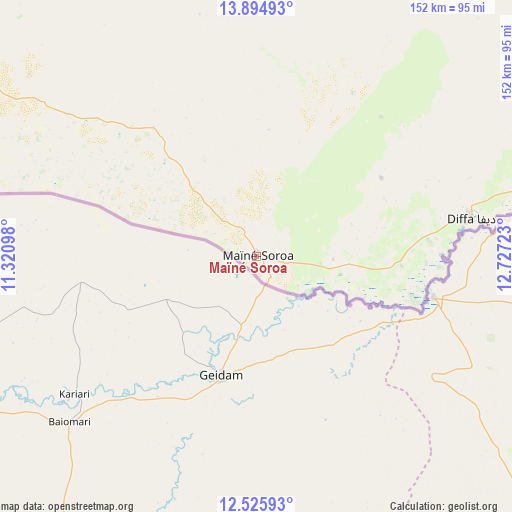
Maïné Soroa GPS coordinates[2]
13° 12' 41.004" North, 12° 1' 26.76" East
| Map corner | latitude | longitude |
|---|---|---|
| Upper-left | 13.89493°, | 11.32098° |
| Center: | 13.21139°, | 12.0241° |
| Lower-right: | 12.52593°, | 12.72723° |
| Map W x H: | 152.2×152.2 km | = 94.6×94.6mi |
| max Lat: | 18.73694° ⇑88.4% North |
| Maïné Soroa: | 13.21139° |
| min Lat: | ⇓11.6% South 11.88435° |
| min Long | Maïné Soroa | max Long |
| 0.75306° | 12.0241° | 13.10921° |
| W 93%⇐ | ⇒7% E |
Elevation
Elevation of Maïné Soroa is 335 m = 1099 ft, and this is 7.8 m = 26 ft below average elevation for this country.
| Max E: |
525 m = 1722 ft | 55.8% |
| Avg. | 342.8 m = 1125 ft | |
| Maïné Soroa | 335 m = 1099 ft | |
Min E: |
177 m = 581 ft | 44.2% |
See also: Niger elevation on elevation.city.
Geographical zone
Maïné Soroa is located in North Torrid zone (between Equator and Tropic of Cancer). Distance of this Northern Tropic circle is 1137 km =706.5 mi to North.| Distance of | km | miles | from Maïné Soroa |
|---|---|---|---|
| North Pole | 8538.1 | 5305.3 | to North |
| Arctic Circle | 5932.2 | 3686.1 | to North |
| Tropic Cancer | 1137 | 706.5 | to North |
| Equator | 1469 | 912.8 | to South |


Nearby cities:
9 places around Maïné Soroa: (largest is in red/bold)
• Diffa
64.6 km =40.1 mi,  79°
79°
• Gouré
208.1 km =129.3 mi,  294°
294°
• Kantché
386.9 km =240.4 mi,  275°
275°
• Magaria
338.1 km =210.1 mi,  265°
265°
• Matamey
384.7 km =239 mi, 273°
• Mirriah
315.6 km =196.1 mi, 280°
• Nguigmi
164.5 km =102.2 mi,  45°
45°
• Tanout
390.7 km =242.8 mi,  300°
300°
• Zinder
334.8 km =208 mi, 281°
Sources, notices
• [Note1] Compared only with cities in Niger existing in our database
• [Src1] Map data: © OpenStreetMap contributors (CC-BY-SA)
• [Src2] Other city data from geonames.org with taken over terms of usage.
• [Src3] Geographical zone / Annual Mean Temperature by Robert A. Rohde @ Wikipedia
