Gouré geodata
Gouré (Zinder) is a seat of a second-order administrative division; located in Niger in Africa/Niamey (GMT+1) time zone. With population of 14,639 people, there are 25 cities with bigger population in this country. Compared to other cities in Niger, 53.5% of cities are located further ↓South; 90.7% of cities are located further ←West and 88.4% of cities have lower elevation than Gouré. Note1


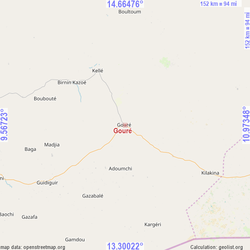
Gouré GPS coordinates[2]
13° 59' 0.6" North, 10° 16' 13.26" East
| Map corner | latitude | longitude |
|---|---|---|
| Upper-left | 14.66476°, | 9.56723° |
| Center: | 13.9835°, | 10.27035° |
| Lower-right: | 13.30022°, | 10.97348° |
| Map W x H: | 151.7×151.7 km | = 94.3×94.3mi |
| max Lat: | 18.73694° ⇑46.5% North |
| Gouré: | 13.9835° |
| min Lat: | ⇓53.5% South 11.88435° |
| min Long | Gouré | max Long |
| 0.75306° | 10.27035° | 13.10921° |
| W 90.7%⇐ | ⇒9.3% E |
Elevation
Elevation of Gouré is 447 m = 1467 ft, and this is 104.2 m = 342 ft above average elevation for this country.
| Max E: |
525 m = 1722 ft | 11.6% |
| Gouré | 447 m 1467 ft | |
| Avg. | 342.8 m = 1125 ft | |
Min E: |
177 m = 581 ft | 88.4% |
See also: Niger elevation on elevation.city.
Geographical zone
Gouré is located in North Torrid zone (between Equator and Tropic of Cancer). Distance of this Northern Tropic circle is 1051.1 km =653.1 mi to North.| Distance of | km | miles | from Gouré |
|---|---|---|---|
| North Pole | 8452.2 | 5252 | to North |
| Arctic Circle | 5846.4 | 3632.8 | to North |
| Tropic Cancer | 1051.1 | 653.1 | to North |
| Equator | 1554.8 | 966.1 | to South |


Nearby cities:
15 places around Gouré: (largest is in red/bold)
• Aguié
274.3 km =170.4 mi,  258°
258°
• Diffa
263.6 km =163.8 mi,  106°
106°
• Kantché
201.3 km =125.1 mi, 255°
• Madarounfa
344.8 km =214.2 mi, 257°
• Magaria
183.4 km =114 mi,  233°
233°
• Maradi
346.4 km =215.2 mi, 261°
• Matamey
203.7 km =126.6 mi,  252°
252°
• Mayahi
280.5 km =174.3 mi,  269°
269°
• Maïné Soroa
208.1 km =129.3 mi, 114°
• Mirriah
124.8 km =77.5 mi, 255°
• Nguigmi
307.5 km =191.1 mi,  84°
84°
• Tanout
184.9 km =114.9 mi,  306°
306°
• Tessaoua
247.7 km =153.9 mi, 264°
• Tibiri
351.1 km =218.2 mi, 262°
• Zinder
139.8 km =86.9 mi, 261°
Sources, notices
• [Note1] Compared only with cities in Niger existing in our database
• [Src1] Map data: © OpenStreetMap contributors (CC-BY-SA)
• [Src2] Other city data from geonames.org with taken over terms of usage.
• [Src3] Geographical zone / Annual Mean Temperature by Robert A. Rohde @ Wikipedia
