Magaria geodata
Magaria (Zinder) is a seat of a second-order administrative division; located in Niger in Africa/Niamey (GMT+1) time zone. With population of 19,419 people, there are 19 cities with bigger population in this country. Compared to other cities in Niger, 97.7% of cities are located further ↑North; 83.7% of cities are located further ←West and 62.8% of cities have lower elevation than Magaria. Note1


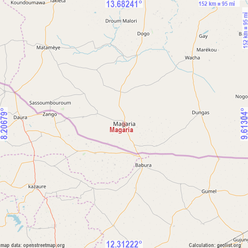
Magaria GPS coordinates[2]
12° 59' 53.736" North, 8° 54' 35.676" East
| Map corner | latitude | longitude |
|---|---|---|
| Upper-left | 13.68241°, | 8.20679° |
| Center: | 12.99826°, | 8.90991° |
| Lower-right: | 12.31222°, | 9.61304° |
| Map W x H: | 152.4×152.4 km | = 94.7×94.7mi |
| max Lat: | 18.73694° ⇑97.7% North |
| Magaria: | 12.99826° |
| min Lat: | ⇓2.3% South 11.88435° |
| min Long | Magaria | max Long |
| 0.75306° | 8.90991° | 13.10921° |
| W 83.7%⇐ | ⇒16.3% E |
Elevation
Elevation of Magaria is 396 m = 1299 ft, and this is 53.2 m = 175 ft above average elevation for this country.
| Max E: |
525 m = 1722 ft | 37.2% |
| Magaria | 396 m 1299 ft | |
| Avg. | 342.8 m = 1125 ft | |
Min E: |
177 m = 581 ft | 62.8% |
See also: Niger elevation on elevation.city.
Geographical zone
Magaria is located in North Torrid zone (between Equator and Tropic of Cancer). Distance of this Northern Tropic circle is 1160.6 km =721.2 mi to North.| Distance of | km | miles | from Magaria |
|---|---|---|---|
| North Pole | 8561.8 | 5320.1 | to North |
| Arctic Circle | 5955.9 | 3700.8 | to North |
| Tropic Cancer | 1160.6 | 721.2 | to North |
| Equator | 1445.3 | 898.1 | to South |


Nearby cities:
15 places around Magaria: (largest is in red/bold)
• Aguié
134.8 km =83.8 mi,  294°
294°
• Dakoro
286.2 km =177.8 mi,  305°
305°
• Gouré
183.4 km =114 mi,  53°
53°
• Guidan Roumdji
250.5 km =155.7 mi, 287°
• Kantché
77.2 km =48 mi,  321°
321°
• Madarounfa
193 km =119.9 mi,  280°
280°
• Maradi
203.5 km =126.4 mi, 285°
• Matamey
66.7 km =41.4 mi, 315°
• Mayahi
171.1 km =106.3 mi, 308°
• Maïné Soroa
338.1 km =210.1 mi,  85°
85°
• Mirriah
83 km =51.6 mi,  18°
18°
• Tanout
219.3 km =136.3 mi,  359°
359°
• Tessaoua
130.7 km =81.2 mi, 310°
• Tibiri
211 km =131.1 mi, 287°
• Zinder
90.3 km =56.1 mi,  5°
5°
Sources, notices
• [Note1] Compared only with cities in Niger existing in our database
• [Src1] Map data: © OpenStreetMap contributors (CC-BY-SA)
• [Src2] Other city data from geonames.org with taken over terms of usage.
• [Src3] Geographical zone / Annual Mean Temperature by Robert A. Rohde @ Wikipedia
