Zadawa geodata
Zadawa (Bauchi) is a populated place; located in Nigeria in Africa/Lagos (GMT+1) time zone. With population of 7,495 people, there are 398 cities with bigger population in this country. Compared to other cities in Nigeria, 76.9% of cities are located further ↓South; 86.3% of cities are located further ←West and 75.4% of cities have lower elevation than Zadawa. Note1


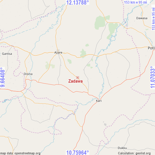
Zadawa GPS coordinates[2]
11° 26' 58.56" North, 10° 22' 1.92" East
| Map corner | latitude | longitude |
|---|---|---|
| Upper-left | 12.13788°, | 9.66408° |
| Center: | 11.4496°, | 10.3672° |
| Lower-right: | 10.75964°, | 11.07033° |
| Map W x H: | 153.2×153.2 km | = 95.2×95.2mi |
| max Lat: | 13.7543° ⇑23.1% North |
| Zadawa: | 11.4496° |
| min Lat: | ⇓76.9% South 4.31231° |
| min Long | Zadawa | max Long |
| 2.73333° | 10.3672° | 14.46552° |
| W 86.3%⇐ | ⇒13.7% E |
Elevation
Elevation of Zadawa is 435 m = 1427 ft, and this is 138.5 m = 454 ft above average elevation for this country.
| Max E: |
1599 m = 5246 ft | 24.6% |
| Zadawa | 435 m 1427 ft | |
| Avg. | 296.5 m = 973 ft | |
Min E: |
2 m = 7 ft | 75.4% |
See also: Nigeria elevation on elevation.city.
Geographical zone
Zadawa is located in North Torrid zone (between Equator and Tropic of Cancer). Distance of Equator is 1273.1 km =791.1 mi to South.| Distance of | km | miles | from Zadawa |
|---|---|---|---|
| North Pole | 8734 | 5427.1 | to North |
| Arctic Circle | 6128.1 | 3807.8 | to North |
| Tropic Cancer | 1332.8 | 828.2 | to North |
| Equator | 1273.1 | 791.1 | to South |


Nearby cities:
15 places around Zadawa: (largest is in red/bold)
• Azare
31.6 km =19.6 mi,  322°
322°
• Dambam
45 km =28 mi,  55°
55°
• Darazo
50.3 km =31.3 mi,  174°
174°
• Disina
49 km =30.4 mi,  274°
274°
• Gabarin
38.8 km =24.1 mi, 167°
• Giade
19.4 km =12.1 mi,  250°
250°
• Gwaram
56.1 km =34.9 mi, 250°
• Itas
63.1 km =39.2 mi, 315°
• Jama’are
53.7 km =33.4 mi,  297°
297°
• Kari
30.9 km =19.2 mi,  136°
136°
• Madara
37.8 km =23.5 mi,  13°
13°
• Misau
18.6 km =11.6 mi, 144°
• Sade
34.8 km =21.6 mi,  106°
106°
• Yana
38.8 km =24.1 mi,  263°
263°
• Yanda Bayo
41.8 km =26 mi,  81°
81°
Sources, notices
• [Note1] Compared only with cities in Nigeria existing in our database
• [Src1] Map data: © OpenStreetMap contributors (CC-BY-SA)
• [Src2] Other city data from geonames.org with taken over terms of usage.
• [Src3] Geographical zone / Annual Mean Temperature by Robert A. Rohde @ Wikipedia
