Azare geodata
Azare (Bauchi) is a seat of a second-order administrative division; located in Nigeria in Africa/Lagos (GMT+1) time zone. With population of 105,687 people, there are 83 cities with bigger population in this country. Compared to other cities in Nigeria, 80% of cities are located further ↓South; 85.4% of cities are located further ←West and 71.8% of cities have lower elevation than Azare. Note1


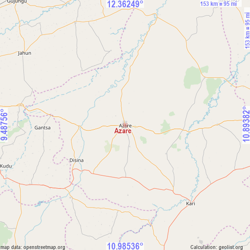
Azare GPS coordinates[2]
11° 40' 29.208" North, 10° 11' 26.484" East
| Map corner | latitude | longitude |
|---|---|---|
| Upper-left | 12.36249°, | 9.48756° |
| Center: | 11.67478°, | 10.19069° |
| Lower-right: | 10.98536°, | 10.89382° |
| Map W x H: | 153.1×153.1 km | = 95.1×95.1mi |
| max Lat: | 13.7543° ⇑20% North |
| Azare: | 11.67478° |
| min Lat: | ⇓80% South 4.31231° |
| min Long | Azare | max Long |
| 2.73333° | 10.19069° | 14.46552° |
| W 85.4%⇐ | ⇒14.6% E |
Elevation
Elevation of Azare is 413 m = 1355 ft, and this is 116.5 m = 382 ft above average elevation for this country.
| Max E: |
1599 m = 5246 ft | 28.2% |
| Azare | 413 m 1355 ft | |
| Avg. | 296.5 m = 973 ft | |
Min E: |
2 m = 7 ft | 71.8% |
See also: Azare elevation on elevation.city.
Geographical zone
Azare is located in North Torrid zone (between Equator and Tropic of Cancer). Distance of Equator is 1298.1 km =806.6 mi to South.| Distance of | km | miles | from Azare |
|---|---|---|---|
| North Pole | 8708.9 | 5411.5 | to North |
| Arctic Circle | 6103.1 | 3792.3 | to North |
| Tropic Cancer | 1307.8 | 812.6 | to North |
| Equator | 1298.1 | 806.6 | to South |


Nearby cities:
15 places around Azare: (largest is in red/bold)
• Dambam
56.3 km =35 mi,  89°
89°
• Disina
36.6 km =22.7 mi,  233°
233°
• Gamawa
63.5 km =39.5 mi,  36°
36°
• Gantsa
50.6 km =31.4 mi,  268°
268°
• Giade
31.6 km =19.6 mi,  178°
178°
• Gwaram
55.4 km =34.4 mi,  217°
217°
• Itas
32 km =19.9 mi,  309°
309°
• Jama’are
28.6 km =17.8 mi, 268°
• Kari
62.4 km =38.8 mi,  139°
139°
• Madara
30.3 km =18.8 mi,  67°
67°
• Misau
50.2 km =31.2 mi, 143°
• Sade
63.2 km =39.3 mi,  123°
123°
• Yana
35.5 km =22.1 mi,  212°
212°
• Yanda Bayo
63.3 km =39.3 mi,  107°
107°
• Zadawa
31.6 km =19.6 mi, 142°
Sources, notices
• [Note1] Compared only with cities in Nigeria existing in our database
• [Src1] Map data: © OpenStreetMap contributors (CC-BY-SA)
• [Src2] Other city data from geonames.org with taken over terms of usage.
• [Src3] Geographical zone / Annual Mean Temperature by Robert A. Rohde @ Wikipedia
