Yanda Bayo geodata
Yanda Bayo (Bauchi) is a populated place; located in Nigeria in Africa/Lagos (GMT+1) time zone. With population of 5,927 people, there are 442 cities with bigger population in this country. Compared to other cities in Nigeria, 77.7% of cities are located further ↓South; 88.2% of cities are located further ←West and 78.3% of cities have lower elevation than Yanda Bayo. Note1


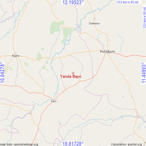
Yanda Bayo GPS coordinates[2]
11° 30' 25.56" North, 10° 44' 45.24" East
| Map corner | latitude | longitude |
|---|---|---|
| Upper-left | 12.19523°, | 10.04278° |
| Center: | 11.5071°, | 10.7459° |
| Lower-right: | 10.81728°, | 11.44903° |
| Map W x H: | 153.2×153.2 km | = 95.2×95.2mi |
| max Lat: | 13.7543° ⇑22.3% North |
| Yanda Bayo: | 11.5071° |
| min Lat: | ⇓77.7% South 4.31231° |
| min Long | Yanda Bayo | max Long |
| 2.73333° | 10.7459° | 14.46552° |
| W 88.2%⇐ | ⇒11.8% E |
Elevation
Elevation of Yanda Bayo is 455 m = 1493 ft, and this is 158.5 m = 520 ft above average elevation for this country.
| Max E: |
1599 m = 5246 ft | 21.7% |
| Yanda Bayo | 455 m 1493 ft | |
| Avg. | 296.5 m = 973 ft | |
Min E: |
2 m = 7 ft | 78.3% |
See also: Nigeria elevation on elevation.city.
Geographical zone
Yanda Bayo is located in North Torrid zone (between Equator and Tropic of Cancer). Distance of Equator is 1279.5 km =795 mi to South.| Distance of | km | miles | from Yanda Bayo |
|---|---|---|---|
| North Pole | 8727.6 | 5423.1 | to North |
| Arctic Circle | 6121.7 | 3803.8 | to North |
| Tropic Cancer | 1326.4 | 824.2 | to North |
| Equator | 1279.5 | 795 | to South |


Nearby cities:
15 places around Yanda Bayo: (largest is in red/bold)
• Azare
63.3 km =39.3 mi,  287°
287°
• Damagum
66.9 km =41.6 mi,  73°
73°
• Dambam
19.5 km =12.1 mi,  347°
347°
• Darazo
67.3 km =41.8 mi,  212°
212°
• Daura
72.1 km =44.8 mi,  85°
85°
• Fika
66 km =41 mi,  111°
111°
• Gabarin
55.1 km =34.2 mi,  216°
216°
• Giade
60.9 km =37.8 mi,  257°
257°
• Kari
35.2 km =21.9 mi, 214°
• Madara
44.4 km =27.6 mi,  313°
313°
• Misau
37.3 km =23.2 mi,  234°
234°
• Potiskum
43.1 km =26.8 mi,  57°
57°
• Sabon Garin Nangere
52.2 km =32.4 mi,  43°
43°
• Sade
18.2 km =11.3 mi, 205°
• Zadawa
41.8 km =26 mi, 261°
Sources, notices
• [Note1] Compared only with cities in Nigeria existing in our database
• [Src1] Map data: © OpenStreetMap contributors (CC-BY-SA)
• [Src2] Other city data from geonames.org with taken over terms of usage.
• [Src3] Geographical zone / Annual Mean Temperature by Robert A. Rohde @ Wikipedia
