Sade geodata
Sade (Bauchi) is a populated place; located in Nigeria in Africa/Lagos (GMT+1) time zone. With population of 8,223 people, there are 377 cities with bigger population in this country. Compared to other cities in Nigeria, 75.7% of cities are located further ↓South; 87.7% of cities are located further ←West and 72% of cities have lower elevation than Sade. Note1


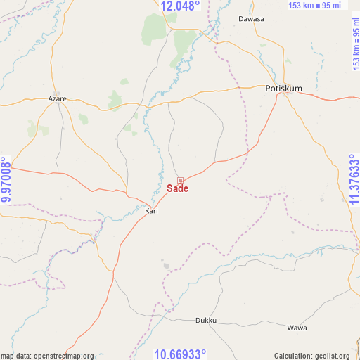
Sade GPS coordinates[2]
11° 21' 34.2" North, 10° 40' 23.52" East
| Map corner | latitude | longitude |
|---|---|---|
| Upper-left | 12.048°, | 9.97008° |
| Center: | 11.3595°, | 10.6732° |
| Lower-right: | 10.66933°, | 11.37633° |
| Map W x H: | 153.3×153.3 km | = 95.3×95.3mi |
| max Lat: | 13.7543° ⇑24.3% North |
| Sade: | 11.3595° |
| min Lat: | ⇓75.7% South 4.31231° |
| min Long | Sade | max Long |
| 2.73333° | 10.6732° | 14.46552° |
| W 87.7%⇐ | ⇒12.3% E |
Elevation
Elevation of Sade is 414 m = 1358 ft, and this is 117.5 m = 385 ft above average elevation for this country.
| Max E: |
1599 m = 5246 ft | 28% |
| Sade | 414 m 1358 ft | |
| Avg. | 296.5 m = 973 ft | |
Min E: |
2 m = 7 ft | 72% |
See also: Nigeria elevation on elevation.city.
Geographical zone
Sade is located in North Torrid zone (between Equator and Tropic of Cancer). Distance of Equator is 1263.1 km =784.9 mi to South.| Distance of | km | miles | from Sade |
|---|---|---|---|
| North Pole | 8744 | 5433.3 | to North |
| Arctic Circle | 6138.1 | 3814 | to North |
| Tropic Cancer | 1342.9 | 834.4 | to North |
| Equator | 1263.1 | 784.9 | to South |


Nearby cities:
15 places around Sade: (largest is in red/bold)
• Azare
63.2 km =39.3 mi,  303°
303°
• Dambam
35.7 km =22.2 mi,  6°
6°
• Darazo
49.2 km =30.6 mi,  215°
215°
• Dukku
60.5 km =37.6 mi,  169°
169°
• Fika
69.7 km =43.3 mi,  96°
96°
• Gabarin
37.4 km =23.2 mi, 221°
• Giade
51.7 km =32.1 mi,  273°
273°
• Kari
17.5 km =10.9 mi, 224°
• Madara
52.8 km =32.8 mi,  332°
332°
• Misau
23.1 km =14.4 mi,  257°
257°
• Potiskum
59.4 km =36.9 mi,  48°
48°
• Sabon Garin Nangere
69.8 km =43.4 mi,  38°
38°
• Yana
72.1 km =44.8 mi, 274°
• Yanda Bayo
18.2 km =11.3 mi,  25°
25°
• Zadawa
34.8 km =21.6 mi,  286°
286°
Sources, notices
• [Note1] Compared only with cities in Nigeria existing in our database
• [Src1] Map data: © OpenStreetMap contributors (CC-BY-SA)
• [Src2] Other city data from geonames.org with taken over terms of usage.
• [Src3] Geographical zone / Annual Mean Temperature by Robert A. Rohde @ Wikipedia
