Gwaram geodata
Gwaram (Jigawa) is a seat of a second-order administrative division; located in Nigeria in Africa/Lagos (GMT+1) time zone. With population of 15,806 people, there are 231 cities with bigger population in this country. Compared to other cities in Nigeria, 74.9% of cities are located further ↓South; 83.5% of cities are located further ←West and 78% of cities have lower elevation than Gwaram. Note1


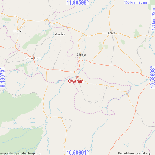
Gwaram GPS coordinates[2]
11° 16' 38.172" North, 9° 53' 1.86" East
| Map corner | latitude | longitude |
|---|---|---|
| Upper-left | 11.96598°, | 9.18073° |
| Center: | 11.27727°, | 9.88385° |
| Lower-right: | 10.58691°, | 10.58698° |
| Map W x H: | 153.3×153.3 km | = 95.3×95.3mi |
| max Lat: | 13.7543° ⇑25.1% North |
| Gwaram: | 11.27727° |
| min Lat: | ⇓74.9% South 4.31231° |
| min Long | Gwaram | max Long |
| 2.73333° | 9.88385° | 14.46552° |
| W 83.5%⇐ | ⇒16.5% E |
Elevation
Elevation of Gwaram is 452 m = 1483 ft, and this is 155.5 m = 510 ft above average elevation for this country.
| Max E: |
1599 m = 5246 ft | 22% |
| Gwaram | 452 m 1483 ft | |
| Avg. | 296.5 m = 973 ft | |
Min E: |
2 m = 7 ft | 78% |
See also: Nigeria elevation on elevation.city.
Geographical zone
Gwaram is located in North Torrid zone (between Equator and Tropic of Cancer). Distance of Equator is 1253.9 km =779.1 mi to South.| Distance of | km | miles | from Gwaram |
|---|---|---|---|
| North Pole | 8753.1 | 5438.9 | to North |
| Arctic Circle | 6147.3 | 3819.8 | to North |
| Tropic Cancer | 1352 | 840.1 | to North |
| Equator | 1253.9 | 779.1 | to South |


Nearby cities:
15 places around Gwaram: (largest is in red/bold)
• Azare
55.4 km =34.4 mi,  37°
37°
• Birnin Kudu
48.3 km =30 mi,  293°
293°
• Disina
23 km =14.3 mi,  9°
9°
• Gabarin
63.9 km =39.7 mi,  106°
106°
• Gantsa
46.2 km =28.7 mi,  338°
338°
• Giade
36.7 km =22.8 mi,  69°
69°
• Itas
65.1 km =40.5 mi, 7°
• Jama’are
43.9 km =27.3 mi, 6°
• Kiyawa
64 km =39.8 mi,  331°
331°
• Misau
63.7 km =39.6 mi,  86°
86°
• Ningi
40.9 km =25.4 mi,  237°
237°
• Samamiya
27.8 km =17.3 mi, 286°
• Warji
18.1 km =11.2 mi,  232°
232°
• Yana
20.2 km =12.6 mi, 44°
• Zadawa
56.1 km =34.9 mi, 70°
Sources, notices
• [Note1] Compared only with cities in Nigeria existing in our database
• [Src1] Map data: © OpenStreetMap contributors (CC-BY-SA)
• [Src2] Other city data from geonames.org with taken over terms of usage.
• [Src3] Geographical zone / Annual Mean Temperature by Robert A. Rohde @ Wikipedia
