Vandeikya geodata
Vandeikya (Benue) is a seat of a second-order administrative division; located in Nigeria in Africa/Lagos (GMT+1) time zone. In our database, there are 451 cities with bigger population. Compared to other cities in Nigeria, 71.3% of cities are located further ↑North; 77.2% of cities are located further ←West and 68.3% of cities have higher elevation than Vandeikya. Note1


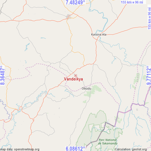
Vandeikya GPS coordinates[2]
6° 47' 5.316" North, 9° 4' 4.764" East
| Map corner | latitude | longitude |
|---|---|---|
| Upper-left | 7.48249°, | 8.36487° |
| Center: | 6.78481°, | 9.06799° |
| Lower-right: | 6.08612°, | 9.77112° |
| Map W x H: | 155.3×155.3 km | = 96.5×96.5mi |
| max Lat: | 13.7543° ⇑71.3% North |
| Vandeikya: | 6.78481° |
| min Lat: | ⇓28.7% South 4.31231° |
| min Long | Vandeikya | max Long |
| 2.73333° | 9.06799° | 14.46552° |
| W 77.2%⇐ | ⇒22.8% E |
Elevation
Elevation of Vandeikya is 157 m = 515 ft, and this is 139.5 m = 458 ft below average elevation for this country.
| Max E: |
1599 m = 5246 ft | 68.3% |
| Avg. | 296.5 m = 973 ft | |
| Vandeikya | 157 m = 515 ft | |
Min E: |
2 m = 7 ft | 31.7% |
See also: Nigeria elevation on elevation.city.
Geographical zone
Vandeikya is located in North Torrid zone (between Equator and Tropic of Cancer). Distance of Equator is 754.4 km =468.8 mi to South.| Distance of | km | miles | from Vandeikya |
|---|---|---|---|
| North Pole | 9252.7 | 5749.4 | to North |
| Arctic Circle | 6646.8 | 4130.1 | to North |
| Tropic Cancer | 1851.5 | 1150.5 | to North |
| Equator | 754.4 | 468.8 | to South |


Nearby cities:
15 places around Vandeikya: (largest is in red/bold)
• Abuochiche
17.2 km =10.7 mi,  232°
232°
• Adikpo
21.7 km =13.5 mi,  57°
57°
• Boje
58 km =36 mi,  196°
196°
• Buruku
76.5 km =47.5 mi,  11°
11°
• Gakem
8.6 km =5.3 mi,  258°
258°
• Gboko
60.3 km =37.5 mi,  352°
352°
• Katsina-Ala
49 km =30.4 mi,  29°
29°
• Lessel
38.4 km =23.9 mi, 352°
• Obudu
16.8 km =10.4 mi,  140°
140°
• Ogoja
32.8 km =20.4 mi,  244°
244°
• Oju
72 km =44.7 mi,  275°
275°
• Okpoma
52 km =32.3 mi,  246°
246°
• Sankwala
31.4 km =19.5 mi,  147°
147°
• Tse-Agberagba
55 km =34.2 mi,  306°
306°
• Yandev
64.4 km =40 mi,  357°
357°
Sources, notices
• [Note1] Compared only with cities in Nigeria existing in our database
• [Src1] Map data: © OpenStreetMap contributors (CC-BY-SA)
• [Src2] Other city data from geonames.org with taken over terms of usage.
• [Src3] Geographical zone / Annual Mean Temperature by Robert A. Rohde @ Wikipedia
