Abuochiche geodata
Abuochiche (Cross River) is a seat of a second-order administrative division; located in Nigeria in Africa/Lagos (GMT+1) time zone. In our database, there are 451 cities with bigger population. Compared to other cities in Nigeria, 72.8% of cities are located further ↑North; 76.1% of cities are located further ←West and 71.6% of cities have higher elevation than Abuochiche. Note1


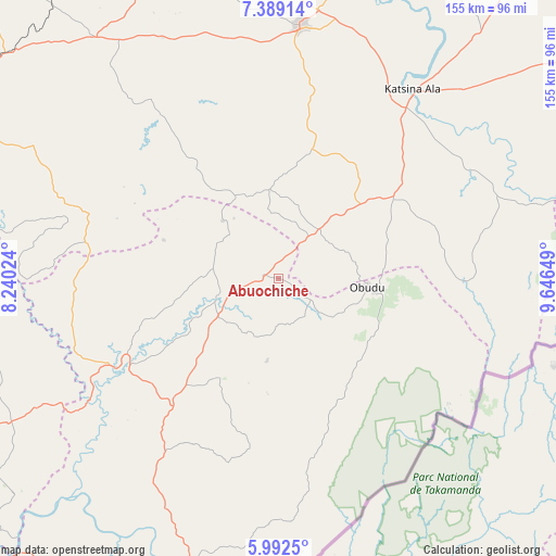
Abuochiche GPS coordinates[2]
6° 41' 28.752" North, 8° 56' 36.132" East
| Map corner | latitude | longitude |
|---|---|---|
| Upper-left | 7.38914°, | 8.24024° |
| Center: | 6.69132°, | 8.94337° |
| Lower-right: | 5.9925°, | 9.64649° |
| Map W x H: | 155.3×155.3 km | = 96.5×96.5mi |
| max Lat: | 13.7543° ⇑72.8% North |
| Abuochiche: | 6.69132° |
| min Lat: | ⇓27.2% South 4.31231° |
| min Long | Abuochiche | max Long |
| 2.73333° | 8.94337° | 14.46552° |
| W 76.1%⇐ | ⇒23.9% E |
Elevation
Elevation of Abuochiche is 139 m = 456 ft, and this is 157.5 m = 517 ft below average elevation for this country.
| Max E: |
1599 m = 5246 ft | 71.6% |
| Avg. | 296.5 m = 973 ft | |
| Abuochiche | 139 m = 456 ft | |
Min E: |
2 m = 7 ft | 28.4% |
See also: Nigeria elevation on elevation.city.
Geographical zone
Abuochiche is located in North Torrid zone (between Equator and Tropic of Cancer). Distance of Equator is 744 km =462.3 mi to South.| Distance of | km | miles | from Abuochiche |
|---|---|---|---|
| North Pole | 9263.1 | 5755.8 | to North |
| Arctic Circle | 6657.2 | 4136.6 | to North |
| Tropic Cancer | 1861.9 | 1156.9 | to North |
| Equator | 744 | 462.3 | to South |


Nearby cities:
15 places around Abuochiche: (largest is in red/bold)
• Adikpo
38.9 km =24.2 mi,  55°
55°
• Boje
45.3 km =28.1 mi,  183°
183°
• Gakem
10.2 km =6.3 mi,  31°
31°
• Gboko
70.5 km =43.8 mi,  5°
5°
• Katsina-Ala
65.1 km =40.5 mi,  35°
35°
• Lessel
49.2 km =30.6 mi, 9°
• Obarike-Ito
77.8 km =48.3 mi,  298°
298°
• Obudu
24.6 km =15.3 mi,  96°
96°
• Ogoja
16.3 km =10.1 mi,  257°
257°
• Oju
60.4 km =37.5 mi,  286°
286°
• Okpoma
35.4 km =22 mi,  252°
252°
• Sankwala
34.7 km =21.6 mi,  117°
117°
• Tse-Agberagba
52.7 km =32.7 mi,  324°
324°
• Vandeikya
17.2 km =10.7 mi,  52°
52°
• Yandev
75.5 km =46.9 mi, 8°
Sources, notices
• [Note1] Compared only with cities in Nigeria existing in our database
• [Src1] Map data: © OpenStreetMap contributors (CC-BY-SA)
• [Src2] Other city data from geonames.org with taken over terms of usage.
• [Src3] Geographical zone / Annual Mean Temperature by Robert A. Rohde @ Wikipedia
