Ukata geodata
Ukata (Niger) is a populated place; located in Nigeria in Africa/Lagos (GMT+1) time zone. With population of 6,188 people, there are 436 cities with bigger population in this country. Compared to other cities in Nigeria, 71.3% of cities are located further ↓South; 72.3% of cities are located further →East and 73.5% of cities have lower elevation than Ukata. Note1


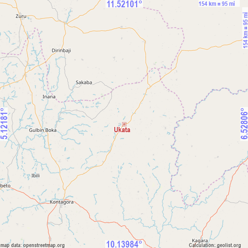
Ukata GPS coordinates[2]
10° 49' 52.392" North, 5° 49' 29.784" East
| Map corner | latitude | longitude |
|---|---|---|
| Upper-left | 11.52101°, | 5.12181° |
| Center: | 10.83122°, | 5.82494° |
| Lower-right: | 10.13984°, | 6.52806° |
| Map W x H: | 153.6×153.6 km | = 95.4×95.4mi |
| max Lat: | 13.7543° ⇑28.7% North |
| Ukata: | 10.83122° |
| min Lat: | ⇓71.3% South 4.31231° |
| min Long | Ukata | max Long |
| 2.73333° | 5.82494° | 14.46552° |
| W 27.7%⇐ | ⇒72.3% E |
Elevation
Elevation of Ukata is 420 m = 1378 ft, and this is 123.5 m = 405 ft above average elevation for this country.
| Max E: |
1599 m = 5246 ft | 26.5% |
| Ukata | 420 m 1378 ft | |
| Avg. | 296.5 m = 973 ft | |
Min E: |
2 m = 7 ft | 73.5% |
See also: Nigeria elevation on elevation.city.
Geographical zone
Ukata is located in North Torrid zone (between Equator and Tropic of Cancer). Distance of Equator is 1204.3 km =748.3 mi to South.| Distance of | km | miles | from Ukata |
|---|---|---|---|
| North Pole | 8802.7 | 5469.7 | to North |
| Arctic Circle | 6196.9 | 3850.6 | to North |
| Tropic Cancer | 1401.6 | 870.9 | to North |
| Equator | 1204.3 | 748.3 | to South |


Nearby cities:
15 places around Ukata: (largest is in red/bold)
• Bangi
0.3 km =0.2 mi,  37°
37°
• Bena
51.8 km =32.2 mi,  13°
13°
• Birnin Gwari
80.3 km =49.9 mi,  103°
103°
• Dan Sadau
89.6 km =55.7 mi,  54°
54°
• Ibeto
83.7 km =52 mi,  242°
242°
• Kagara
85.7 km =53.3 mi,  146°
146°
• Kontagora
61.3 km =38.1 mi,  219°
219°
• Kusheriki
75.2 km =46.7 mi,  116°
116°
• Mando
82 km =51 mi, 98°
• Ribah
72.9 km =45.3 mi,  329°
329°
• Rijau
69.2 km =43 mi,  296°
296°
• Sakaba
36.1 km =22.4 mi,  316°
316°
• Tegina
93.5 km =58.1 mi, 154°
• Wasagu
60.7 km =37.7 mi,  356°
356°
• Zuru
93 km =57.8 mi, 316°
Sources, notices
• [Note1] Compared only with cities in Nigeria existing in our database
• [Src1] Map data: © OpenStreetMap contributors (CC-BY-SA)
• [Src2] Other city data from geonames.org with taken over terms of usage.
• [Src3] Geographical zone / Annual Mean Temperature by Robert A. Rohde @ Wikipedia
