Sakaba geodata
Sakaba (Kebbi) is a seat of a second-order administrative division; located in Nigeria in Africa/Lagos (GMT+1) time zone. In our database, there are 451 cities with bigger population. Compared to other cities in Nigeria, 72.8% of cities are located further ↓South; 74.7% of cities are located further →East and 62.2% of cities have lower elevation than Sakaba. Note1


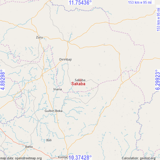
Sakaba GPS coordinates[2]
11° 3' 54.468" North, 5° 35' 45.96" East
| Map corner | latitude | longitude |
|---|---|---|
| Upper-left | 11.75436°, | 4.89298° |
| Center: | 11.06513°, | 5.5961° |
| Lower-right: | 10.37428°, | 6.29923° |
| Map W x H: | 153.5×153.5 km | = 95.4×95.4mi |
| max Lat: | 13.7543° ⇑27.2% North |
| Sakaba: | 11.06513° |
| min Lat: | ⇓72.8% South 4.31231° |
| min Long | Sakaba | max Long |
| 2.73333° | 5.5961° | 14.46552° |
| W 25.3%⇐ | ⇒74.7% E |
Elevation
Elevation of Sakaba is 356 m = 1168 ft, and this is 59.5 m = 195 ft above average elevation for this country.
| Max E: |
1599 m = 5246 ft | 37.8% |
| Sakaba | 356 m 1168 ft | |
| Avg. | 296.5 m = 973 ft | |
Min E: |
2 m = 7 ft | 62.2% |
See also: Nigeria elevation on elevation.city.
Geographical zone
Sakaba is located in North Torrid zone (between Equator and Tropic of Cancer). Distance of Equator is 1230.3 km =764.5 mi to South.| Distance of | km | miles | from Sakaba |
|---|---|---|---|
| North Pole | 8776.7 | 5453.6 | to North |
| Arctic Circle | 6170.8 | 3834.4 | to North |
| Tropic Cancer | 1375.6 | 854.8 | to North |
| Equator | 1230.3 | 764.5 | to South |


Nearby cities:
15 places around Sakaba: (largest is in red/bold)
• Bangi
36 km =22.4 mi,  135°
135°
• Bena
44.3 km =27.5 mi,  56°
56°
• Bin Yauri
91.3 km =56.7 mi,  249°
249°
• Dabai
62.4 km =38.8 mi,  317°
317°
• Duku
77.5 km =48.2 mi,  284°
284°
• Ibeto
81.1 km =50.4 mi,  217°
217°
• Kontagora
74.9 km =46.5 mi,  190°
190°
• Mahuta
86.3 km =53.6 mi,  309°
309°
• Nasko
99 km =61.5 mi,  230°
230°
• Ribah
38.7 km =24 mi,  341°
341°
• Rijau
37.4 km =23.2 mi, 276°
• Ukata
36.1 km =22.4 mi, 136°
• Wasagu
40.9 km =25.4 mi,  32°
32°
• Yelwa
96.6 km =60 mi, 254°
• Zuru
57 km =35.4 mi, 316°
Sources, notices
• [Note1] Compared only with cities in Nigeria existing in our database
• [Src1] Map data: © OpenStreetMap contributors (CC-BY-SA)
• [Src2] Other city data from geonames.org with taken over terms of usage.
• [Src3] Geographical zone / Annual Mean Temperature by Robert A. Rohde @ Wikipedia
