Gwarzo geodata
Gwarzo (Kano) is a seat of a second-order administrative division; located in Nigeria in Africa/Lagos (GMT+1) time zone. With population of 16,303 people, there are 226 cities with bigger population in this country. Compared to other cities in Nigeria, 83.3% of cities are located further ↓South; 62.3% of cities are located further ←West and 91.9% of cities have lower elevation than Gwarzo. Note1


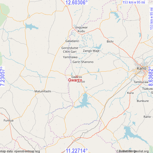
Gwarzo GPS coordinates[2]
11° 54' 57.492" North, 7° 56' 1.32" East
| Map corner | latitude | longitude |
|---|---|---|
| Upper-left | 12.60306°, | 7.23057° |
| Center: | 11.91597°, | 7.9337° |
| Lower-right: | 11.22714°, | 8.63682° |
| Map W x H: | 153×153 km | = 95.1×95.1mi |
| max Lat: | 13.7543° ⇑16.7% North |
| Gwarzo: | 11.91597° |
| min Lat: | ⇓83.3% South 4.31231° |
| min Long | Gwarzo | max Long |
| 2.73333° | 7.9337° | 14.46552° |
| W 62.3%⇐ | ⇒37.7% E |
Elevation
Elevation of Gwarzo is 581 m = 1906 ft, and this is 284.5 m = 933 ft above average elevation for this country.
| Max E: |
1599 m = 5246 ft | 8.1% |
| Gwarzo | 581 m 1906 ft | |
| Avg. | 296.5 m = 973 ft | |
Min E: |
2 m = 7 ft | 91.9% |
See also: Nigeria elevation on elevation.city.
Geographical zone
Gwarzo is located in North Torrid zone (between Equator and Tropic of Cancer). Distance of this Northern Tropic circle is 1281 km =796 mi to North.| Distance of | km | miles | from Gwarzo |
|---|---|---|---|
| North Pole | 8682.1 | 5394.8 | to North |
| Arctic Circle | 6076.2 | 3775.6 | to North |
| Tropic Cancer | 1281 | 796 | to North |
| Equator | 1324.9 | 823.3 | to South |


Nearby cities:
15 places around Gwarzo: (largest is in red/bold)
• Bagwai
34.7 km =21.6 mi,  39°
39°
• Gora
29.2 km =18.1 mi,  269°
269°
• Jikamshi
33.5 km =20.8 mi,  328°
328°
• Kabo
26.6 km =16.5 mi,  104°
104°
• Kafur
40 km =24.9 mi,  221°
221°
• Karaye
17.2 km =10.7 mi,  148°
148°
• Kiru
32.3 km =20.1 mi,  137°
137°
• Madobi
41.5 km =25.8 mi,  111°
111°
• Malumfashi
36.9 km =22.9 mi,  247°
247°
• Musawa
37.2 km =23.1 mi,  309°
309°
• Rimin Gado
34.6 km =21.5 mi,  80°
80°
• Rogo
42.2 km =26.2 mi,  196°
196°
• Shanono
16.4 km =10.2 mi,  22°
22°
• Tofa
40.1 km =24.9 mi,  66°
66°
• Tsanyawa
42.6 km =26.5 mi,  7°
7°
Sources, notices
• [Note1] Compared only with cities in Nigeria existing in our database
• [Src1] Map data: © OpenStreetMap contributors (CC-BY-SA)
• [Src2] Other city data from geonames.org with taken over terms of usage.
• [Src3] Geographical zone / Annual Mean Temperature by Robert A. Rohde @ Wikipedia
