Gora geodata
Gora (Katsina) is a populated place; located in Nigeria in Africa/Lagos (GMT+1) time zone. With population of 5,867 people, there are 444 cities with bigger population in this country. Compared to other cities in Nigeria, 83.2% of cities are located further ↓South; 57% of cities are located further ←West and 92.5% of cities have lower elevation than Gora. Note1


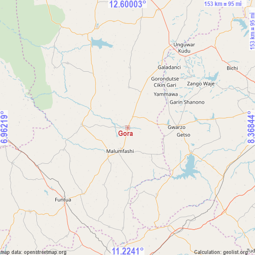
Gora GPS coordinates[2]
11° 54' 46.584" North, 7° 39' 55.116" East
| Map corner | latitude | longitude |
|---|---|---|
| Upper-left | 12.60003°, | 6.96219° |
| Center: | 11.91294°, | 7.66531° |
| Lower-right: | 11.2241°, | 8.36844° |
| Map W x H: | 153×153 km | = 95.1×95.1mi |
| max Lat: | 13.7543° ⇑16.8% North |
| Gora: | 11.91294° |
| min Lat: | ⇓83.2% South 4.31231° |
| min Long | Gora | max Long |
| 2.73333° | 7.66531° | 14.46552° |
| W 57%⇐ | ⇒43% E |
Elevation
Elevation of Gora is 593 m = 1946 ft, and this is 296.5 m = 973 ft above average elevation for this country.
| Max E: |
1599 m = 5246 ft | 7.5% |
| Gora | 593 m 1946 ft | |
| Avg. | 296.5 m = 973 ft | |
Min E: |
2 m = 7 ft | 92.5% |
See also: Nigeria elevation on elevation.city.
Geographical zone
Gora is located in North Torrid zone (between Equator and Tropic of Cancer). Distance of this Northern Tropic circle is 1281.3 km =796.2 mi to North.| Distance of | km | miles | from Gora |
|---|---|---|---|
| North Pole | 8682.5 | 5395.1 | to North |
| Arctic Circle | 6076.6 | 3775.8 | to North |
| Tropic Cancer | 1281.3 | 796.2 | to North |
| Equator | 1324.6 | 823.1 | to South |


Nearby cities:
15 places around Gora: (largest is in red/bold)
• Bakori
47.6 km =29.6 mi,  213°
213°
• Dan Musa
52.9 km =32.9 mi,  317°
317°
• Gwarzo
29.2 km =18.1 mi,  89°
89°
• Jikamshi
31.3 km =19.4 mi,  22°
22°
• Kabo
55.3 km =34.4 mi,  96°
96°
• Kafur
29.8 km =18.5 mi,  174°
174°
• Kankara
27.7 km =17.2 mi,  274°
274°
• Karaye
40.7 km =25.3 mi,  110°
110°
• Kiru
56.2 km =34.9 mi, 114°
• Malumfashi
14.6 km =9.1 mi,  199°
199°
• Matazu
35.9 km =22.3 mi,  1°
1°
• Musawa
24.1 km =15 mi, 1°
• Rogo
43.6 km =27.1 mi,  156°
156°
• Shanono
38.7 km =24 mi,  66°
66°
• Tsanyawa
55 km =34.2 mi,  39°
39°
Sources, notices
• [Note1] Compared only with cities in Nigeria existing in our database
• [Src1] Map data: © OpenStreetMap contributors (CC-BY-SA)
• [Src2] Other city data from geonames.org with taken over terms of usage.
• [Src3] Geographical zone / Annual Mean Temperature by Robert A. Rohde @ Wikipedia
