Karaye geodata
Karaye (Kano) is a seat of a second-order administrative division; located in Nigeria in Africa/Lagos (GMT+1) time zone. In our database, there are 451 cities with bigger population. Compared to other cities in Nigeria, 81.7% of cities are located further ↓South; 64% of cities are located further ←West and 89.1% of cities have lower elevation than Karaye. Note1


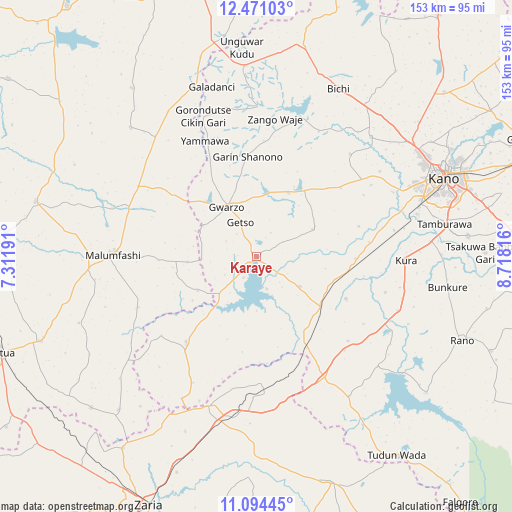
Karaye GPS coordinates[2]
11° 47' 0.96" North, 8° 0' 54.144" East
| Map corner | latitude | longitude |
|---|---|---|
| Upper-left | 12.47103°, | 7.31191° |
| Center: | 11.7836°, | 8.01504° |
| Lower-right: | 11.09445°, | 8.71816° |
| Map W x H: | 153.1×153.1 km | = 95.1×95.1mi |
| max Lat: | 13.7543° ⇑18.3% North |
| Karaye: | 11.7836° |
| min Lat: | ⇓81.7% South 4.31231° |
| min Long | Karaye | max Long |
| 2.73333° | 8.01504° | 14.46552° |
| W 64%⇐ | ⇒36% E |
Elevation
Elevation of Karaye is 542 m = 1778 ft, and this is 245.5 m = 805 ft above average elevation for this country.
| Max E: |
1599 m = 5246 ft | 10.9% |
| Karaye | 542 m 1778 ft | |
| Avg. | 296.5 m = 973 ft | |
Min E: |
2 m = 7 ft | 89.1% |
See also: Nigeria elevation on elevation.city.
Geographical zone
Karaye is located in North Torrid zone (between Equator and Tropic of Cancer). Distance of this Northern Tropic circle is 1295.7 km =805.1 mi to North.| Distance of | km | miles | from Karaye |
|---|---|---|---|
| North Pole | 8696.8 | 5403.9 | to North |
| Arctic Circle | 6091 | 3784.8 | to North |
| Tropic Cancer | 1295.7 | 805.1 | to North |
| Equator | 1310.2 | 814.1 | to South |


Nearby cities:
15 places around Karaye: (largest is in red/bold)
• Bagwai
43.6 km =27.1 mi,  17°
17°
• Bebeji
29.8 km =18.5 mi,  115°
115°
• Dan Gora
31.4 km =19.5 mi,  151°
151°
• Garun Malam
40.1 km =24.9 mi,  105°
105°
• Gora
40.7 km =25.3 mi,  290°
290°
• Gwarzo
17.2 km =10.7 mi,  328°
328°
• Kabo
18.7 km =11.6 mi,  64°
64°
• Kafur
38.5 km =23.9 mi,  246°
246°
• Kiru
15.9 km =9.9 mi, 124°
• Madobi
29.7 km =18.5 mi,  91°
91°
• Malumfashi
42.9 km =26.7 mi,  270°
270°
• Rimin Gado
32.5 km =20.2 mi,  51°
51°
• Rogo
33.2 km =20.6 mi,  219°
219°
• Shanono
29.9 km =18.6 mi,  355°
355°
• Tofa
41.5 km =25.8 mi,  42°
42°
Sources, notices
• [Note1] Compared only with cities in Nigeria existing in our database
• [Src1] Map data: © OpenStreetMap contributors (CC-BY-SA)
• [Src2] Other city data from geonames.org with taken over terms of usage.
• [Src3] Geographical zone / Annual Mean Temperature by Robert A. Rohde @ Wikipedia
