Bomadi geodata
Bomadi (Delta) is a seat of a second-order administrative division; located in Nigeria in Africa/Lagos (GMT+1) time zone. With population of 8,402 people, there are 373 cities with bigger population in this country. Compared to other cities in Nigeria, 92.4% of cities are located further ↑North; 71.3% of cities are located further →East and 95.5% of cities have higher elevation than Bomadi. Note1


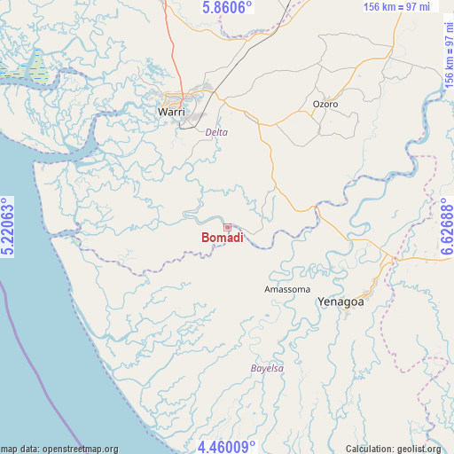
Bomadi GPS coordinates[2]
5° 9' 38.628" North, 5° 55' 25.5" East
| Map corner | latitude | longitude |
|---|---|---|
| Upper-left | 5.8606°, | 5.22063° |
| Center: | 5.16073°, | 5.92375° |
| Lower-right: | 4.46009°, | 6.62688° |
| Map W x H: | 155.7×155.7 km | = 96.7×96.7mi |
| max Lat: | 13.7543° ⇑92.4% North |
| Bomadi: | 5.16073° |
| min Lat: | ⇓7.6% South 4.31231° |
| min Long | Bomadi | max Long |
| 2.73333° | 5.92375° | 14.46552° |
| W 28.7%⇐ | ⇒71.3% E |
Elevation
Elevation of Bomadi is 11 m = 36 ft, and this is 285.5 m = 937 ft below average elevation for this country.
| Max E: |
1599 m = 5246 ft | 95.5% |
| Avg. | 296.5 m = 973 ft | |
| Bomadi | 11 m = 36 ft | |
Min E: |
2 m = 7 ft | 4.5% |
See also: Nigeria elevation on elevation.city.
Geographical zone
Bomadi is located in North Torrid zone (between Equator and Tropic of Cancer). Distance of Equator is 573.8 km =356.5 mi to South.| Distance of | km | miles | from Bomadi |
|---|---|---|---|
| North Pole | 9433.2 | 5861.5 | to North |
| Arctic Circle | 6827.4 | 4242.3 | to North |
| Tropic Cancer | 2032.1 | 1262.7 | to North |
| Equator | 573.8 | 356.5 | to South |


Nearby cities:
15 places around Bomadi: (largest is in red/bold)
• Amassoma
29.5 km =18.3 mi,  135°
135°
• Burutu
50.7 km =31.5 mi,  294°
294°
• Effurun
46.6 km =29 mi,  340°
340°
• Ekeremor
19.5 km =12.1 mi,  234°
234°
• Isiokolo
49.1 km =30.5 mi,  9°
9°
• Kaiama
42 km =26.1 mi,  96°
96°
• Oleh
45.8 km =28.5 mi,  43°
43°
• Oporoma
43.1 km =26.8 mi,  156°
156°
• Otor-Udu
33.1 km =20.6 mi,  349°
349°
• Otu-Jeremi
31.3 km =19.4 mi, 350°
• Patani
30.6 km =19 mi,  75°
75°
• Sagbama
30.2 km =18.8 mi,  90°
90°
• Ughelli
37.6 km =23.4 mi, 13°
• Warri
44.1 km =27.4 mi,  334°
334°
• Yenagoa
46.1 km =28.6 mi,  124°
124°
Sources, notices
• [Note1] Compared only with cities in Nigeria existing in our database
• [Src1] Map data: © OpenStreetMap contributors (CC-BY-SA)
• [Src2] Other city data from geonames.org with taken over terms of usage.
• [Src3] Geographical zone / Annual Mean Temperature by Robert A. Rohde @ Wikipedia
