Albasu geodata
Albasu (Kano) is a seat of a second-order administrative division; located in Nigeria in Africa/Lagos (GMT+1) time zone. In our database, there are 451 cities with bigger population. Compared to other cities in Nigeria, 79.9% of cities are located further ↓South; 77.9% of cities are located further ←West and 76.6% of cities have lower elevation than Albasu. Note1


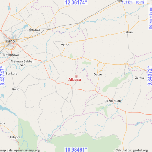
Albasu GPS coordinates[2]
11° 40' 26.508" North, 9° 8' 26.124" East
| Map corner | latitude | longitude |
|---|---|---|
| Upper-left | 12.36174°, | 8.43747° |
| Center: | 11.67403°, | 9.14059° |
| Lower-right: | 10.98461°, | 9.84372° |
| Map W x H: | 153.1×153.1 km | = 95.1×95.1mi |
| max Lat: | 13.7543° ⇑20.1% North |
| Albasu: | 11.67403° |
| min Lat: | ⇓79.9% South 4.31231° |
| min Long | Albasu | max Long |
| 2.73333° | 9.14059° | 14.46552° |
| W 77.9%⇐ | ⇒22.1% E |
Elevation
Elevation of Albasu is 443 m = 1453 ft, and this is 146.5 m = 481 ft above average elevation for this country.
| Max E: |
1599 m = 5246 ft | 23.4% |
| Albasu | 443 m 1453 ft | |
| Avg. | 296.5 m = 973 ft | |
Min E: |
2 m = 7 ft | 76.6% |
See also: Nigeria elevation on elevation.city.
Geographical zone
Albasu is located in North Torrid zone (between Equator and Tropic of Cancer). Distance of Equator is 1298 km =806.5 mi to South.| Distance of | km | miles | from Albasu |
|---|---|---|---|
| North Pole | 8709 | 5411.5 | to North |
| Arctic Circle | 6103.1 | 3792.3 | to North |
| Tropic Cancer | 1307.9 | 812.7 | to North |
| Equator | 1298 | 806.5 | to South |


Nearby cities:
15 places around Albasu: (largest is in red/bold)
• Ajingi
34.6 km =21.5 mi,  340°
340°
• Birnin Kudu
44.3 km =27.5 mi,  123°
123°
• Burumburum
55.3 km =34.4 mi,  235°
235°
• Dawakin Kudu
61.9 km =38.5 mi,  287°
287°
• Dutse
23.4 km =14.5 mi,  67°
67°
• Garko
36.8 km =22.9 mi,  265°
265°
• Gaya
25.6 km =15.9 mi,  324°
324°
• Kibiya
54.7 km =34 mi,  252°
252°
• Kiyawa
52.2 km =32.4 mi,  76°
76°
• Ringim
53.1 km =33 mi,  2°
2°
• Sumaila
25.7 km =16 mi,  231°
231°
• Takai
11.5 km =7.1 mi,  197°
197°
• Warawa
52.4 km =32.6 mi, 294°
• Wudil
35.6 km =22.1 mi,  295°
295°
• Zakirai
54.9 km =34.1 mi,  329°
329°
Sources, notices
• [Note1] Compared only with cities in Nigeria existing in our database
• [Src1] Map data: © OpenStreetMap contributors (CC-BY-SA)
• [Src2] Other city data from geonames.org with taken over terms of usage.
• [Src3] Geographical zone / Annual Mean Temperature by Robert A. Rohde @ Wikipedia
