Masachapa geodata
Masachapa (Managua) is a populated place; located in Nicaragua in America/Managua (GMT-6) time zone. With population of 5,000 people, there are 76 cities with bigger population in this country. Compared to other cities in Nicaragua, 86.8% of cities are located further ↑North; 80.8% of cities are located further →East and 94% of cities have higher elevation than Masachapa. Note1


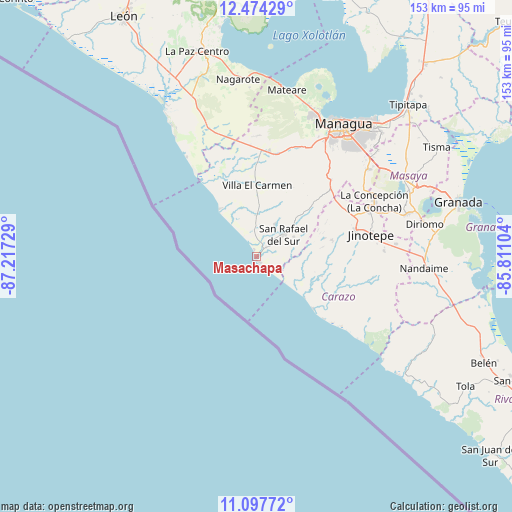
Masachapa GPS coordinates[2]
11° 47' 12.732" North, 86° 30' 50.976" West
| Map corner | latitude | longitude |
|---|---|---|
| Upper-left | 12.47429°, | -87.21729° |
| Center: | 11.78687°, | -86.51416° |
| Lower-right: | 11.09772°, | -85.81104° |
| Map W x H: | 153.1×153.1 km | = 95.1×95.1mi |
| max Lat: | 14.74189° ⇑86.8% North |
| Masachapa: | 11.78687° |
| min Lat: | ⇓13.2% South 10.94684° |
| min Long | Masachapa | max Long |
| -87.4516° | -86.51416° | -83.06145° |
| W 19.2%⇐ | ⇒80.8% E |
Elevation
Elevation of Masachapa is 12 m = 39 ft, and this is 325.2 m = 1067 ft below average elevation for this country.
| Max E: |
1288 m = 4226 ft | 94% |
| Avg. | 337.2 m = 1106 ft | |
| Masachapa | 12 m = 39 ft | |
Min E: |
1 m = 3 ft | 6% |
See also: Nicaragua elevation on elevation.city.
Geographical zone
Masachapa is located in North Torrid zone (between Equator and Tropic of Cancer). Distance of this Northern Tropic circle is 1295.3 km =804.9 mi to North.| Distance of | km | miles | from Masachapa |
|---|---|---|---|
| North Pole | 8696.5 | 5403.8 | to North |
| Arctic Circle | 6090.6 | 3784.5 | to North |
| Tropic Cancer | 1295.3 | 804.9 | to North |
| Equator | 1310.6 | 814.4 | to South |


Nearby cities:
15 places around Masachapa: (largest is in red/bold)
• Diriamba
31 km =19.3 mi,  75°
75°
• Dolores
33.4 km =20.8 mi, 76°
• El Crucero
31.7 km =19.7 mi,  44°
44°
• El Rosario
15.3 km =9.5 mi,  93°
93°
• El Rosario
38.3 km =23.8 mi, 82°
• Jinotepe
35 km =21.7 mi, 78°
• La Concepción
39.1 km =24.3 mi,  64°
64°
• La Conquista
35.5 km =22.1 mi,  99°
99°
• La Paz de Carazo
42.2 km =26.2 mi, 84°
• Masatepe
42.6 km =26.5 mi,  70°
70°
• San Marcos
36.5 km =22.7 mi, 68°
• San Rafael del Sur
10.7 km =6.6 mi,  50°
50°
• Santa Teresa
33 km =20.5 mi, 98°
• Santa Teresa
38.2 km =23.7 mi, 87°
• Villa El Carmen
21.5 km =13.4 mi,  2°
2°
Sources, notices
• [Note1] Compared only with cities in Nicaragua existing in our database
• [Src1] Map data: © OpenStreetMap contributors (CC-BY-SA)
• [Src2] Other city data from geonames.org with taken over terms of usage.
• [Src3] Geographical zone / Annual Mean Temperature by Robert A. Rohde @ Wikipedia
