La Trinidad geodata
La Trinidad (Estelí) is a seat of a second-order administrative division; located in Nicaragua in America/Managua (GMT-6) time zone. In our database, there are 137 cities with bigger population. Compared to other cities in Nicaragua, 67.1% of cities are located further ↓South; 65.3% of cities are located further →East and 81.4% of cities have lower elevation than La Trinidad. Note1


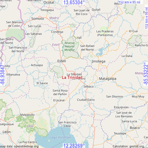
La Trinidad GPS coordinates[2]
12° 58' 7.716" North, 86° 14' 7.224" West
| Map corner | latitude | longitude |
|---|---|---|
| Upper-left | 13.65304°, | -86.93847° |
| Center: | 12.96881°, | -86.23534° |
| Lower-right: | 12.28269°, | -85.53222° |
| Map W x H: | 152.4×152.4 km | = 94.7×94.7mi |
| max Lat: | 14.74189° ⇑32.9% North |
| La Trinidad: | 12.96881° |
| min Lat: | ⇓67.1% South 10.94684° |
| min Long | La Trinidad | max Long |
| -87.4516° | -86.23534° | -83.06145° |
| W 34.7%⇐ | ⇒65.3% E |
Elevation
Elevation of La Trinidad is 611 m = 2005 ft, and this is 273.8 m = 898 ft above average elevation for this country.
| Max E: |
1288 m = 4226 ft | 18.6% |
| La Trinidad | 611 m 2005 ft | |
| Avg. | 337.2 m = 1106 ft | |
Min E: |
1 m = 3 ft | 81.4% |
See also: Nicaragua elevation on elevation.city.
Geographical zone
La Trinidad is located in North Torrid zone (between Equator and Tropic of Cancer). Distance of this Northern Tropic circle is 1163.9 km =723.2 mi to North.| Distance of | km | miles | from La Trinidad |
|---|---|---|---|
| North Pole | 8565.1 | 5322.1 | to North |
| Arctic Circle | 5959.2 | 3702.9 | to North |
| Tropic Cancer | 1163.9 | 723.2 | to North |
| Equator | 1442 | 896 | to South |


Nearby cities:
15 places around La Trinidad: (largest is in red/bold)
• Ciudad Darío
29 km =18 mi,  155°
155°
• El Jicaral
31.2 km =19.4 mi,  210°
210°
• El Sauce
34.1 km =21.2 mi,  254°
254°
• Estelí
18.8 km =11.7 mi,  316°
316°
• Jinotega
28.7 km =17.8 mi,  61°
61°
• LLano de La Cruz
30.1 km =18.7 mi,  54°
54°
• La Concordia
26.3 km =16.3 mi,  16°
16°
• Matagalpa
34.8 km =21.6 mi,  97°
97°
• San Isidro
6.2 km =3.9 mi,  135°
135°
• San Nicolás
12.9 km =8 mi, 251°
• San Rafael del Norte
30.3 km =18.8 mi,  26°
26°
• San Sebastián de Yalí
37.8 km =23.5 mi,  8°
8°
• Santa Rosa del Peñón
23.7 km =14.7 mi,  218°
218°
• Sébaco
19.8 km =12.3 mi,  130°
130°
• Terrabona
39.5 km =24.5 mi, 132°
Sources, notices
• [Note1] Compared only with cities in Nicaragua existing in our database
• [Src1] Map data: © OpenStreetMap contributors (CC-BY-SA)
• [Src2] Other city data from geonames.org with taken over terms of usage.
• [Src3] Geographical zone / Annual Mean Temperature by Robert A. Rohde @ Wikipedia
