San Nicolás geodata
San Nicolás (Estelí) is a seat of a second-order administrative division; located in Nicaragua in America/Managua (GMT-6) time zone. In our database, there are 137 cities with bigger population. Compared to other cities in Nicaragua, 65.3% of cities are located further ↓South; 71.3% of cities are located further →East and 97% of cities have lower elevation than San Nicolás. Note1


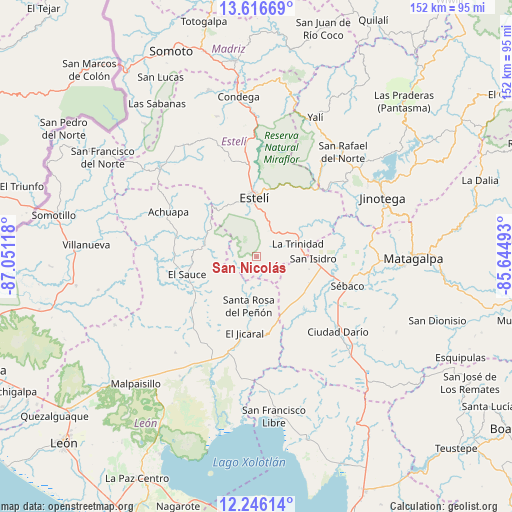
San Nicolás GPS coordinates[2]
12° 55' 56.496" North, 86° 20' 52.98" West
| Map corner | latitude | longitude |
|---|---|---|
| Upper-left | 13.61669°, | -87.05118° |
| Center: | 12.93236°, | -86.34805° |
| Lower-right: | 12.24614°, | -85.64493° |
| Map W x H: | 152.4×152.4 km | = 94.7×94.7mi |
| max Lat: | 14.74189° ⇑34.7% North |
| San Nicolás: | 12.93236° |
| min Lat: | ⇓65.3% South 10.94684° |
| min Long | San Nicolás | max Long |
| -87.4516° | -86.34805° | -83.06145° |
| W 28.7%⇐ | ⇒71.3% E |
Elevation
Elevation of San Nicolás is 990 m = 3248 ft, and this is 652.8 m = 2142 ft above average elevation for this country.
| Max E: |
1288 m = 4226 ft | 3% |
| San Nicolás | 990 m 3248 ft | |
| Avg. | 337.2 m = 1106 ft | |
Min E: |
1 m = 3 ft | 97% |
See also: Nicaragua elevation on elevation.city.
Geographical zone
San Nicolás is located in North Torrid zone (between Equator and Tropic of Cancer). Distance of this Northern Tropic circle is 1168 km =725.8 mi to North.| Distance of | km | miles | from San Nicolás |
|---|---|---|---|
| North Pole | 8569.1 | 5324.6 | to North |
| Arctic Circle | 5963.2 | 3705.4 | to North |
| Tropic Cancer | 1168 | 725.8 | to North |
| Equator | 1437.9 | 893.5 | to South |


Nearby cities:
15 places around San Nicolás: (largest is in red/bold)
• Achuapa
29.5 km =18.3 mi,  297°
297°
• Ciudad Darío
33 km =20.5 mi,  132°
132°
• El Jicaral
23.1 km =14.4 mi,  188°
188°
• El Sauce
21.3 km =13.2 mi,  256°
256°
• Estelí
17.7 km =11 mi,  357°
357°
• Jinotega
41.4 km =25.7 mi,  64°
64°
• LLano de La Cruz
42.6 km =26.5 mi, 59°
• La Concordia
35.2 km =21.9 mi,  33°
33°
• La Trinidad
12.9 km =8 mi,  71°
71°
• Larreynaga
37.4 km =23.2 mi,  220°
220°
• San Isidro
16.6 km =10.3 mi,  91°
91°
• San Juan de Limay
39.4 km =24.5 mi,  313°
313°
• San Rafael del Norte
40.4 km =25.1 mi,  39°
39°
• Santa Rosa del Peñón
14.8 km =9.2 mi, 189°
• Sébaco
28.7 km =17.8 mi,  107°
107°
Sources, notices
• [Note1] Compared only with cities in Nicaragua existing in our database
• [Src1] Map data: © OpenStreetMap contributors (CC-BY-SA)
• [Src2] Other city data from geonames.org with taken over terms of usage.
• [Src3] Geographical zone / Annual Mean Temperature by Robert A. Rohde @ Wikipedia
