Jalapa geodata
Jalapa (Nueva Segovia) is a seat of a second-order administrative division; located in Nicaragua in America/Managua (GMT-6) time zone. With population of 24,037 people, there are 23 cities with bigger population in this country. Compared to other cities in Nicaragua, 97.6% of cities are located further ↓South; 54.5% of cities are located further →East and 86.2% of cities have lower elevation than Jalapa. Note1


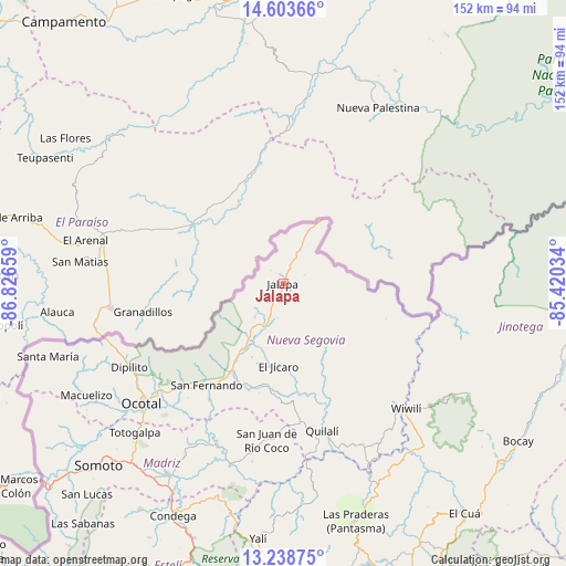
Jalapa GPS coordinates[2]
13° 55' 19.956" North, 86° 7' 24.456" West
| Map corner | latitude | longitude |
|---|---|---|
| Upper-left | 14.60366°, | -86.82659° |
| Center: | 13.92221°, | -86.12346° |
| Lower-right: | 13.23875°, | -85.42034° |
| Map W x H: | 151.8×151.8 km | = 94.3×94.3mi |
| max Lat: | 14.74189° ⇑2.4% North |
| Jalapa: | 13.92221° |
| min Lat: | ⇓97.6% South 10.94684° |
| min Long | Jalapa | max Long |
| -87.4516° | -86.12346° | -83.06145° |
| W 45.5%⇐ | ⇒54.5% E |
Elevation
Elevation of Jalapa is 686 m = 2251 ft, and this is 348.8 m = 1144 ft above average elevation for this country.
| Max E: |
1288 m = 4226 ft | 13.8% |
| Jalapa | 686 m 2251 ft | |
| Avg. | 337.2 m = 1106 ft | |
Min E: |
1 m = 3 ft | 86.2% |
See also: Nicaragua elevation on elevation.city.
Geographical zone
Jalapa is located in North Torrid zone (between Equator and Tropic of Cancer). Distance of this Northern Tropic circle is 1057.9 km =657.3 mi to North.| Distance of | km | miles | from Jalapa |
|---|---|---|---|
| North Pole | 8459.1 | 5256.2 | to North |
| Arctic Circle | 5853.2 | 3637 | to North |
| Tropic Cancer | 1057.9 | 657.3 | to North |
| Equator | 1548 | 961.9 | to South |


Nearby cities:
15 places around Jalapa: (largest is in red/bold)
• Ciudad Antigua
37.1 km =23.1 mi,  212°
212°
• Dipilto
47 km =29.2 mi,  241°
241°
• El Jícaro
22.2 km =13.8 mi,  184°
184°
• Mozonte
44.8 km =27.8 mi,  229°
229°
• Murra
21.4 km =13.3 mi,  148°
148°
• Ocotal
49.8 km =30.9 mi, 229°
• Palacagüina
60.2 km =37.4 mi, 210°
• Quilalí
40.9 km =25.4 mi,  165°
165°
• San Fernando
34.2 km =21.3 mi,  217°
217°
• San Juan de Río Coco
42.2 km =26.2 mi,  186°
186°
• Telpaneca
46.9 km =29.1 mi,  202°
202°
• Totogalpa
56.4 km =35 mi, 224°
• Wiwili
46.7 km =29 mi,  136°
136°
• Wiwilí
46 km =28.6 mi, 135°
• Wiwilí de Jinotega
47.6 km =29.6 mi, 135°
Sources, notices
• [Note1] Compared only with cities in Nicaragua existing in our database
• [Src1] Map data: © OpenStreetMap contributors (CC-BY-SA)
• [Src2] Other city data from geonames.org with taken over terms of usage.
• [Src3] Geographical zone / Annual Mean Temperature by Robert A. Rohde @ Wikipedia
