Altagracia geodata
Altagracia (Rivas) is a populated place; located in Nicaragua in America/Managua (GMT-6) time zone. With population of 2,771 people, there are 96 cities with bigger population in this country. Compared to other cities in Nicaragua, 91.6% of cities are located further ↑North; 73.1% of cities are located further ←West and 76.6% of cities have higher elevation than Altagracia. Note1


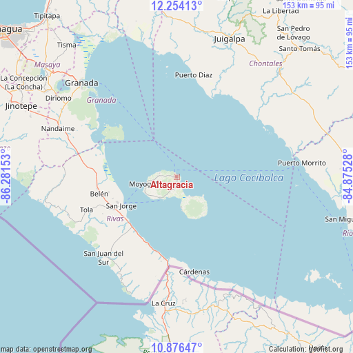
Altagracia GPS coordinates[2]
11° 33' 58.14" North, 85° 34' 42.24" West
| Map corner | latitude | longitude |
|---|---|---|
| Upper-left | 12.25413°, | -86.28153° |
| Center: | 11.56615°, | -85.5784° |
| Lower-right: | 10.87647°, | -84.87528° |
| Map W x H: | 153.2×153.2 km | = 95.2×95.2mi |
| max Lat: | 14.74189° ⇑91.6% North |
| Altagracia: | 11.56615° |
| min Lat: | ⇓8.4% South 10.94684° |
| min Long | Altagracia | max Long |
| -87.4516° | -85.5784° | -83.06145° |
| W 73.1%⇐ | ⇒26.9% E |
Elevation
Elevation of Altagracia is 66 m = 217 ft, and this is 271.2 m = 890 ft below average elevation for this country.
| Max E: |
1288 m = 4226 ft | 76.6% |
| Avg. | 337.2 m = 1106 ft | |
| Altagracia | 66 m = 217 ft | |
Min E: |
1 m = 3 ft | 23.4% |
See also: Nicaragua elevation on elevation.city.
Geographical zone
Altagracia is located in North Torrid zone (between Equator and Tropic of Cancer). Distance of Equator is 1286 km =799.1 mi to South.| Distance of | km | miles | from Altagracia |
|---|---|---|---|
| North Pole | 8721 | 5419 | to North |
| Arctic Circle | 6115.1 | 3799.7 | to North |
| Tropic Cancer | 1319.9 | 820.1 | to North |
| Equator | 1286 | 799.1 | to South |


Nearby cities:
15 places around Altagracia: (largest is in red/bold)
• Acoyapa
63.1 km =39.2 mi,  44°
44°
• Belén
34.6 km =21.5 mi,  258°
258°
• Buenos Aires
28.1 km =17.5 mi,  247°
247°
• Cárdenas
41.8 km =26 mi,  169°
169°
• Diriomo
62 km =38.5 mi,  303°
303°
• Diriá
62.8 km =39 mi, 304°
• Granada
57.7 km =35.9 mi,  314°
314°
• Morrito
54.6 km =33.9 mi,  83°
83°
• Moyogalpa
13.3 km =8.3 mi, 257°
• Nandaime
55.9 km =34.7 mi,  292°
292°
• Potosí
31.4 km =19.5 mi, 255°
• Rivas
30.6 km =19 mi,  242°
242°
• San Jorge
27.4 km =17 mi, 243°
• San Juan del Sur
47.2 km =29.3 mi,  222°
222°
• Tola
41.7 km =25.9 mi, 250°
Sources, notices
• [Note1] Compared only with cities in Nicaragua existing in our database
• [Src1] Map data: © OpenStreetMap contributors (CC-BY-SA)
• [Src2] Other city data from geonames.org with taken over terms of usage.
• [Src3] Geographical zone / Annual Mean Temperature by Robert A. Rohde @ Wikipedia
