Acoyapa geodata
Acoyapa (Chontales) is a seat of a second-order administrative division; located in Nicaragua in America/Managua (GMT-6) time zone. With population of 10,563 people, there are 43 cities with bigger population in this country. Compared to other cities in Nicaragua, 75.4% of cities are located further ↑North; 80.8% of cities are located further ←West and 70.1% of cities have higher elevation than Acoyapa. Note1


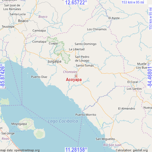
Acoyapa GPS coordinates[2]
11° 58' 13.008" North, 85° 10' 16.068" West
| Map corner | latitude | longitude |
|---|---|---|
| Upper-left | 12.65722°, | -85.87426° |
| Center: | 11.97028°, | -85.17113° |
| Lower-right: | 11.28158°, | -84.46801° |
| Map W x H: | 153×153 km | = 95.1×95.1mi |
| max Lat: | 14.74189° ⇑75.4% North |
| Acoyapa: | 11.97028° |
| min Lat: | ⇓24.6% South 10.94684° |
| min Long | Acoyapa | max Long |
| -87.4516° | -85.17113° | -83.06145° |
| W 80.8%⇐ | ⇒19.2% E |
Elevation
Elevation of Acoyapa is 101 m = 331 ft, and this is 236.2 m = 775 ft below average elevation for this country.
| Max E: |
1288 m = 4226 ft | 70.1% |
| Avg. | 337.2 m = 1106 ft | |
| Acoyapa | 101 m = 331 ft | |
Min E: |
1 m = 3 ft | 29.9% |
See also: Nicaragua elevation on elevation.city.
Geographical zone
Acoyapa is located in North Torrid zone (between Equator and Tropic of Cancer). Distance of this Northern Tropic circle is 1274.9 km =792.2 mi to North.| Distance of | km | miles | from Acoyapa |
|---|---|---|---|
| North Pole | 8676.1 | 5391.1 | to North |
| Arctic Circle | 6070.2 | 3771.8 | to North |
| Tropic Cancer | 1274.9 | 792.2 | to North |
| Equator | 1331 | 827 | to South |


Nearby cities:
15 places around Acoyapa: (largest is in red/bold)
• Altagracia
63.1 km =39.2 mi,  224°
224°
• Camoapa
59.1 km =36.7 mi,  321°
321°
• Comalapa
50.8 km =31.6 mi,  313°
313°
• Cuapa
40.3 km =25 mi,  325°
325°
• El Almendro
60.4 km =37.5 mi,  122°
122°
• El Ayote
27.6 km =17.1 mi, 332°
• El Coral
57.2 km =35.5 mi,  95°
95°
• Juigalpa
25.9 km =16.1 mi, 305°
• La Libertad
27.4 km =17 mi,  1°
1°
• Morrito
40 km =24.9 mi,  165°
165°
• San Miguelito
69.7 km =43.3 mi,  154°
154°
• San Pedro de Lóvago
18.7 km =11.6 mi,  18°
18°
• Santo Domingo
34.1 km =21.2 mi, 16°
• Santo Tomás
14.1 km =8.8 mi,  38°
38°
• Villa Sandino
21.2 km =13.2 mi,  65°
65°
Sources, notices
• [Note1] Compared only with cities in Nicaragua existing in our database
• [Src1] Map data: © OpenStreetMap contributors (CC-BY-SA)
• [Src2] Other city data from geonames.org with taken over terms of usage.
• [Src3] Geographical zone / Annual Mean Temperature by Robert A. Rohde @ Wikipedia
