Westmaas geodata
Westmaas (South Holland) is a populated place; located in Netherlands in Europe/Amsterdam (GMT+2) time zone. With population of 1,760 people, there are 1030 cities with bigger population in this country. Compared to other cities in Netherlands, 65.4% of cities are located further ↑North; 90% of cities are located further →East and 96.1% of cities have higher elevation than Westmaas. Note1


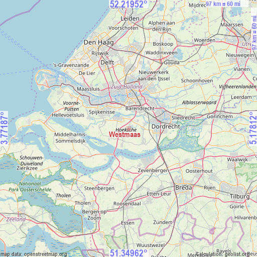
Westmaas GPS coordinates[2]
51° 47' 12.012" North, 4° 28' 30" East
| Map corner | latitude | longitude |
|---|---|---|
| Upper-left | 52.21952°, | 3.77187° |
| Center: | 51.78667°, | 4.475° |
| Lower-right: | 51.34962°, | 5.17812° |
| Map W x H: | 96.7×96.7 km | = 60.1×60.1mi |
| max Lat: | 53.48025° ⇑65.4% North |
| Westmaas: | 51.78667° |
| min Lat: | ⇓34.6% South 50.76917° |
| min Long | Westmaas | max Long |
| 3.38611° | 4.475° | 7.16528° |
| W 10%⇐ | ⇒90% E |
Elevation
Elevation of Westmaas is -1 m = -3 ft, and this is 16 m = 52 ft below average elevation for this country.
| Max E: |
203 m = 666 ft | 96.1% |
| Avg. | 15 m = 49 ft | |
| Westmaas | -1 m = -3 ft | |
Min E: |
-6 m = -20 ft | 3.9% |
See also: Netherlands elevation on elevation.city.
Geographical zone
Westmaas is located in North temperate zone (between Tropic of Cancer and the Arctic Circle). Distance of this North polar circle is 1643 km =1020.9 mi to North.| Distance of | km | miles | from Westmaas |
|---|---|---|---|
| North Pole | 4248.9 | 2640.1 | to North |
| Arctic Circle | 1643 | 1020.9 | to North |
| Tropic Cancer | 3152.2 | 1958.7 | to South |
| Equator | 5758.1 | 3577.9 | to South |


Nearby cities:
15 places around Westmaas: (largest is in red/bold)
• Barendrecht
8.8 km =5.5 mi,  27°
27°
• Heerjansdam
8.2 km =5.1 mi,  48°
48°
• Heinenoord
4.4 km =2.7 mi,  1°
1°
• Klaaswaal
2.7 km =1.7 mi,  227°
227°
• Maasdam
5.5 km =3.4 mi,  87°
87°
• Middelsluis
5.4 km =3.4 mi,  205°
205°
• Mijnsheerenland
1.4 km =0.9 mi,  37°
37°
• Nieuw-Beijerland
9.5 km =5.9 mi,  287°
287°
• Numansdorp
6.6 km =4.1 mi,  202°
202°
• Oud-Beijerland
6 km =3.7 mi,  314°
314°
• Pendrecht
9.4 km =5.8 mi,  357°
357°
• Rhoon
8.7 km =5.4 mi,  335°
335°
• Smitshoek
7.7 km =4.8 mi, 4°
• Strijen
7 km =4.3 mi,  131°
131°
• Zuid-Beijerland
8.4 km =5.2 mi,  241°
241°
Sources, notices
• [Note1] Compared only with cities in Netherlands existing in our database
• [Src1] Map data: © OpenStreetMap contributors (CC-BY-SA)
• [Src2] Other city data from geonames.org with taken over terms of usage.
• [Src3] Geographical zone / Annual Mean Temperature by Robert A. Rohde @ Wikipedia
