Mijnsheerenland geodata
Mijnsheerenland (South Holland) is a populated place; located in Netherlands in Europe/Amsterdam (GMT+2) time zone. With population of 1,775 people, there are 1027 cities with bigger population in this country. Compared to other cities in Netherlands, 64.8% of cities are located further ↑North; 89.3% of cities are located further →East and 96.1% of cities have higher elevation than Mijnsheerenland. Note1


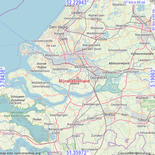
Mijnsheerenland GPS coordinates[2]
51° 47' 48.012" North, 4° 29' 15" East
| Map corner | latitude | longitude |
|---|---|---|
| Upper-left | 52.22943°, | 3.78438° |
| Center: | 51.79667°, | 4.4875° |
| Lower-right: | 51.35972°, | 5.19063° |
| Map W x H: | 96.7×96.7 km | = 60.1×60.1mi |
| max Lat: | 53.48025° ⇑64.8% North |
| Mijnsheerenland: | 51.79667° |
| min Lat: | ⇓35.2% South 50.76917° |
| min Long | Mijnsheerenland | max Long |
| 3.38611° | 4.4875° | 7.16528° |
| W 10.7%⇐ | ⇒89.3% E |
Elevation
Elevation of Mijnsheerenland is -1 m = -3 ft, and this is 16 m = 52 ft below average elevation for this country.
| Max E: |
203 m = 666 ft | 96.1% |
| Avg. | 15 m = 49 ft | |
| Mijnsheerenland | -1 m = -3 ft | |
Min E: |
-6 m = -20 ft | 3.9% |
See also: Netherlands elevation on elevation.city.
Geographical zone
Mijnsheerenland is located in North temperate zone (between Tropic of Cancer and the Arctic Circle). Distance of this North polar circle is 1641.9 km =1020.2 mi to North.| Distance of | km | miles | from Mijnsheerenland |
|---|---|---|---|
| North Pole | 4247.8 | 2639.5 | to North |
| Arctic Circle | 1641.9 | 1020.2 | to North |
| Tropic Cancer | 3153.3 | 1959.4 | to South |
| Equator | 5759.2 | 3578.6 | to South |


Nearby cities:
15 places around Mijnsheerenland: (largest is in red/bold)
• Barendrecht
7.4 km =4.6 mi,  25°
25°
• Heerjansdam
6.8 km =4.2 mi,  50°
50°
• Heinenoord
3.3 km =2.1 mi,  347°
347°
• Klaaswaal
4.1 km =2.5 mi,  224°
224°
• Lombardijen
8.9 km =5.5 mi,  15°
15°
• Maasdam
4.8 km =3 mi,  100°
100°
• Middelsluis
6.8 km =4.2 mi,  207°
207°
• Numansdorp
8 km =5 mi, 205°
• Oud-Beijerland
6 km =3.7 mi,  300°
300°
• Pendrecht
8.4 km =5.2 mi, 351°
• Rhoon
8.1 km =5 mi,  326°
326°
• Smitshoek
6.6 km =4.1 mi,  357°
357°
• Strijen
7.2 km =4.5 mi,  142°
142°
• Westmaas
1.4 km =0.9 mi, 217°
• Zuidwijk
8.7 km =5.4 mi, 358°
Sources, notices
• [Note1] Compared only with cities in Netherlands existing in our database
• [Src1] Map data: © OpenStreetMap contributors (CC-BY-SA)
• [Src2] Other city data from geonames.org with taken over terms of usage.
• [Src3] Geographical zone / Annual Mean Temperature by Robert A. Rohde @ Wikipedia
