Sexbierum geodata
Sexbierum (Friesland) is a populated place; located in Netherlands in Europe/Amsterdam (GMT+2) time zone. With population of 1,530 people, there are 1115 cities with bigger population in this country. Compared to other cities in Netherlands, 94.3% of cities are located further ↓South; 57.3% of cities are located further →East and 58.8% of cities have higher elevation than Sexbierum. Note1


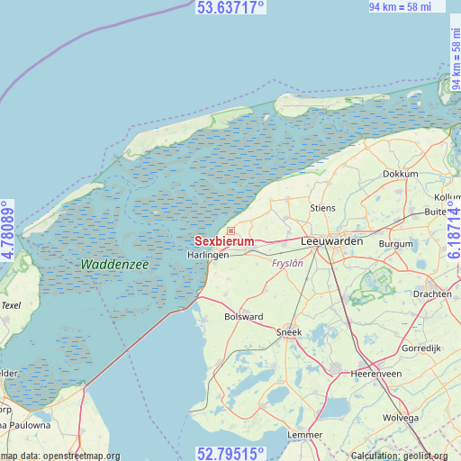
Sexbierum GPS coordinates[2]
53° 13' 5.628" North, 5° 29' 2.472" East
| Map corner | latitude | longitude |
|---|---|---|
| Upper-left | 53.63717°, | 4.78089° |
| Center: | 53.21823°, | 5.48402° |
| Lower-right: | 52.79515°, | 6.18714° |
| Map W x H: | 93.6×93.6 km | = 58.2×58.2mi |
| max Lat: | 53.48025° ⇑5.7% North |
| Sexbierum: | 53.21823° |
| min Lat: | ⇓94.3% South 50.76917° |
| min Long | Sexbierum | max Long |
| 3.38611° | 5.48402° | 7.16528° |
| W 42.7%⇐ | ⇒57.3% E |
Elevation
Elevation of Sexbierum is 4 m = 13 ft, and this is 11 m = 36 ft below average elevation for this country.
| Max E: |
203 m = 666 ft | 58.8% |
| Avg. | 15 m = 49 ft | |
| Sexbierum | 4 m = 13 ft | |
Min E: |
-6 m = -20 ft | 41.2% |
See also: Netherlands elevation on elevation.city.
Geographical zone
Sexbierum is located in North temperate zone (between Tropic of Cancer and the Arctic Circle). Distance of this North polar circle is 1483.9 km =922.1 mi to North.| Distance of | km | miles | from Sexbierum |
|---|---|---|---|
| North Pole | 4089.7 | 2541.2 | to North |
| Arctic Circle | 1483.9 | 922.1 | to North |
| Tropic Cancer | 3311.4 | 2057.6 | to South |
| Equator | 5917.3 | 3676.8 | to South |


Nearby cities:
15 places around Sexbierum: (largest is in red/bold)
• Achlum
7.7 km =4.8 mi,  180°
180°
• Arum
9.9 km =6.2 mi, 182°
• Berltsum
11.5 km =7.1 mi,  75°
75°
• Dronryp
11.2 km =7 mi,  100°
100°
• Franeker
5.3 km =3.3 mi,  133°
133°
• Harlingen
6.3 km =3.9 mi,  220°
220°
• Menaam
11.8 km =7.3 mi,  90°
90°
• Midlum
4.7 km =2.9 mi,  210°
210°
• Minnertsga
8.2 km =5.1 mi,  63°
63°
• Sint Annaparochie
13.2 km =8.2 mi, 60°
• Sint Jacobiparochie
10 km =6.2 mi,  52°
52°
• Tzum
8.4 km =5.2 mi,  141°
141°
• Tzummarum
4.6 km =2.9 mi, 62°
• Winsum
12.4 km =7.7 mi, 126°
• Witmarsum
12.7 km =7.9 mi, 184°
Sources, notices
• [Note1] Compared only with cities in Netherlands existing in our database
• [Src1] Map data: © OpenStreetMap contributors (CC-BY-SA)
• [Src2] Other city data from geonames.org with taken over terms of usage.
• [Src3] Geographical zone / Annual Mean Temperature by Robert A. Rohde @ Wikipedia
