Arum geodata
Arum (Friesland) is a populated place; located in Netherlands in Europe/Amsterdam (GMT+2) time zone. With population of 895 people, there are 1467 cities with bigger population in this country. Compared to other cities in Netherlands, 89.7% of cities are located further ↓South; 57.6% of cities are located further →East and 91.3% of cities have higher elevation than Arum. Note1


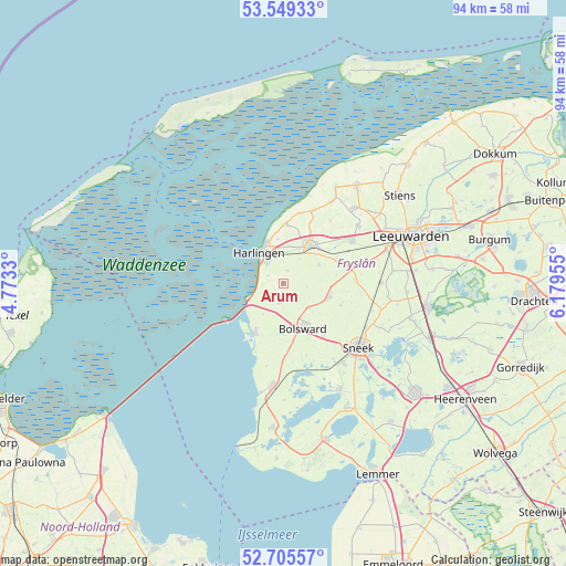
Arum GPS coordinates[2]
53° 7' 46.272" North, 5° 28' 35.148" East
| Map corner | latitude | longitude |
|---|---|---|
| Upper-left | 53.54933°, | 4.7733° |
| Center: | 53.12952°, | 5.47643° |
| Lower-right: | 52.70557°, | 6.17955° |
| Map W x H: | 93.8×93.8 km | = 58.3×58.3mi |
| max Lat: | 53.48025° ⇑10.3% North |
| Arum: | 53.12952° |
| min Lat: | ⇓89.7% South 50.76917° |
| min Long | Arum | max Long |
| 3.38611° | 5.47643° | 7.16528° |
| W 42.4%⇐ | ⇒57.6% E |
Elevation
Elevation of Arum is 0 m = 0 ft, and this is 15 m = 49 ft below average elevation for this country.
| Max E: |
203 m = 666 ft | 91.3% |
| Avg. | 15 m = 49 ft | |
| Arum | 0 m = 0 ft | |
Min E: |
-6 m = -20 ft | 8.7% |
See also: Netherlands elevation on elevation.city.
Geographical zone
Arum is located in North temperate zone (between Tropic of Cancer and the Arctic Circle). Distance of this North polar circle is 1493.7 km =928.1 mi to North.| Distance of | km | miles | from Arum |
|---|---|---|---|
| North Pole | 4099.6 | 2547.4 | to North |
| Arctic Circle | 1493.7 | 928.1 | to North |
| Tropic Cancer | 3301.5 | 2051.5 | to South |
| Equator | 5907.4 | 3670.7 | to South |


Nearby cities:
15 places around Arum: (largest is in red/bold)
• Achlum
2.2 km =1.4 mi,  12°
12°
• Blauwhuis
12.6 km =7.8 mi,  162°
162°
• Bolsward
8 km =5 mi,  152°
152°
• Dronryp
14 km =8.7 mi,  55°
55°
• Franeker
7.6 km =4.7 mi,  34°
34°
• Harlingen
6.2 km =3.9 mi,  324°
324°
• Makkum
9.7 km =6 mi,  210°
210°
• Midlum
6.1 km =3.8 mi,  342°
342°
• Nijland
11 km =6.8 mi,  143°
143°
• Sexbierum
9.9 km =6.2 mi,  2°
2°
• Tzum
6.6 km =4.1 mi, 60°
• Tzummarum
12.9 km =8 mi,  21°
21°
• Winsum
10.8 km =6.7 mi,  76°
76°
• Witmarsum
2.8 km =1.7 mi,  190°
190°
• Wommels
7.8 km =4.8 mi,  107°
107°
Sources, notices
• [Note1] Compared only with cities in Netherlands existing in our database
• [Src1] Map data: © OpenStreetMap contributors (CC-BY-SA)
• [Src2] Other city data from geonames.org with taken over terms of usage.
• [Src3] Geographical zone / Annual Mean Temperature by Robert A. Rohde @ Wikipedia
