Oploo geodata
Oploo (North Brabant) is a populated place; located in Netherlands in Europe/Amsterdam (GMT+2) time zone. With population of 975 people, there are 1421 cities with bigger population in this country. Compared to other cities in Netherlands, 73.5% of cities are located further ↑North; 62.2% of cities are located further ←West and 78.8% of cities have lower elevation than Oploo. Note1


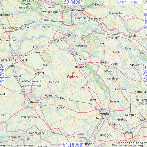
Oploo GPS coordinates[2]
51° 36' 29.988" North, 5° 52' 24.996" East
| Map corner | latitude | longitude |
|---|---|---|
| Upper-left | 52.0429°, | 5.17049° |
| Center: | 51.60833°, | 5.87361° |
| Lower-right: | 51.16956°, | 6.57674° |
| Map W x H: | 97.1×97.1 km | = 60.3×60.3mi |
| max Lat: | 53.48025° ⇑73.5% North |
| Oploo: | 51.60833° |
| min Lat: | ⇓26.5% South 50.76917° |
| min Long | Oploo | max Long |
| 3.38611° | 5.87361° | 7.16528° |
| W 62.2%⇐ | ⇒37.8% E |
Elevation
Elevation of Oploo is 20 m = 66 ft, and this is 5 m = 16 ft above average elevation for this country.
| Max E: |
203 m = 666 ft | 21.2% |
| Oploo | 20 m 66 ft | |
| Avg. | 15 m = 49 ft | |
Min E: |
-6 m = -20 ft | 78.8% |
See also: Netherlands elevation on elevation.city.
Geographical zone
Oploo is located in North temperate zone (between Tropic of Cancer and the Arctic Circle). Distance of this North polar circle is 1662.9 km =1033.3 mi to North.| Distance of | km | miles | from Oploo |
|---|---|---|---|
| North Pole | 4268.8 | 2652.5 | to North |
| Arctic Circle | 1662.9 | 1033.3 | to North |
| Tropic Cancer | 3132.4 | 1946.4 | to South |
| Equator | 5738.3 | 3565.6 | to South |


Nearby cities:
15 places around Oploo: (largest is in red/bold)
• Boxmeer
6.6 km =4.1 mi,  50°
50°
• Brabander
10.4 km =6.5 mi,  141°
141°
• De Rips
7.8 km =4.8 mi,  214°
214°
• Elsendorp
7.8 km =4.8 mi,  246°
246°
• Haps
9 km =5.6 mi,  354°
354°
• Heijen
10.5 km =6.5 mi,  44°
44°
• Merselo
9.5 km =5.9 mi,  156°
156°
• Overloon
6.5 km =4 mi,  128°
128°
• Sint Anthonis
2.1 km =1.3 mi,  15°
15°
• Sint Hubert
9 km =5.6 mi,  329°
329°
• Veltum
11.5 km =7.1 mi,  148°
148°
• Venhorst
9.4 km =5.8 mi,  270°
270°
• Venray
11.6 km =7.2 mi, 142°
• Wanroij
6.7 km =4.2 mi,  324°
324°
• Wilbertoord
8.6 km =5.3 mi,  307°
307°
Sources, notices
• [Note1] Compared only with cities in Netherlands existing in our database
• [Src1] Map data: © OpenStreetMap contributors (CC-BY-SA)
• [Src2] Other city data from geonames.org with taken over terms of usage.
• [Src3] Geographical zone / Annual Mean Temperature by Robert A. Rohde @ Wikipedia
