Boxmeer geodata
Boxmeer (North Brabant) is a populated place; located in Netherlands in Europe/Amsterdam (GMT+2) time zone. With population of 12,407 people, there are 246 cities with bigger population in this country. Compared to other cities in Netherlands, 71.6% of cities are located further ↑North; 67.5% of cities are located further ←West and 70.6% of cities have lower elevation than Boxmeer. Note1


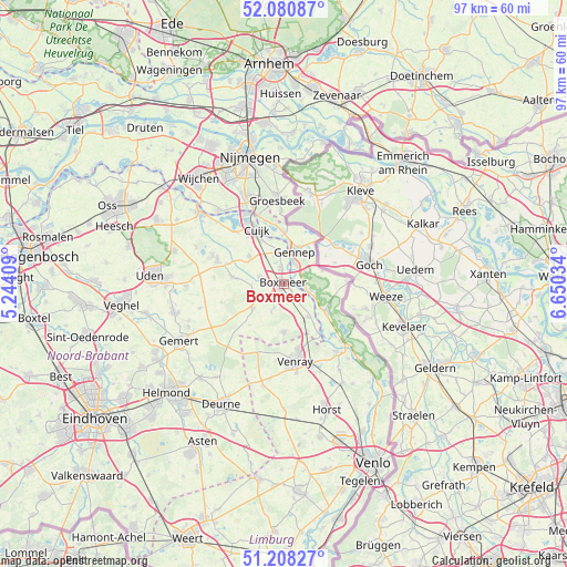
Boxmeer GPS coordinates[2]
51° 38' 48.012" North, 5° 56' 49.992" East
| Map corner | latitude | longitude |
|---|---|---|
| Upper-left | 52.08087°, | 5.24409° |
| Center: | 51.64667°, | 5.94722° |
| Lower-right: | 51.20827°, | 6.65034° |
| Map W x H: | 97×97 km | = 60.3×60.3mi |
| max Lat: | 53.48025° ⇑71.6% North |
| Boxmeer: | 51.64667° |
| min Lat: | ⇓28.4% South 50.76917° |
| min Long | Boxmeer | max Long |
| 3.38611° | 5.94722° | 7.16528° |
| W 67.5%⇐ | ⇒32.5% E |
Elevation
Elevation of Boxmeer is 15 m = 49 ft, and this is 0 m = 0 ft above average elevation for this country.
| Max E: |
203 m = 666 ft | 29.4% |
| Boxmeer | 15 m 49 ft | |
| Avg. | 15 m = 49 ft | |
Min E: |
-6 m = -20 ft | 70.6% |
See also: Netherlands elevation on elevation.city.
Geographical zone
Boxmeer is located in North temperate zone (between Tropic of Cancer and the Arctic Circle). Distance of this North polar circle is 1658.6 km =1030.6 mi to North.| Distance of | km | miles | from Boxmeer |
|---|---|---|---|
| North Pole | 4264.5 | 2649.8 | to North |
| Arctic Circle | 1658.6 | 1030.6 | to North |
| Tropic Cancer | 3136.7 | 1949.1 | to South |
| Equator | 5742.6 | 3568.3 | to South |


Nearby cities:
15 places around Boxmeer: (largest is in red/bold)
• Beers
12.1 km =7.5 mi,  316°
316°
• Cuijk
10.5 km =6.5 mi,  333°
333°
• Gennep
6 km =3.7 mi,  17°
17°
• Haps
7.6 km =4.7 mi,  308°
308°
• Heijen
3.9 km =2.4 mi,  36°
36°
• Milsbeek
8.7 km =5.4 mi,  0°
0°
• Oploo
6.6 km =4.1 mi,  230°
230°
• Ottersum
6.8 km =4.2 mi, 21°
• Overloon
8.3 km =5.2 mi,  180°
180°
• Sint Anthonis
5 km =3.1 mi,  243°
243°
• Sint Hubert
10.2 km =6.3 mi,  290°
290°
• Ven-Zelderheide
9 km =5.6 mi, 35°
• Vianen
10.1 km =6.3 mi, 322°
• Wanroij
9 km =5.6 mi,  277°
277°
• Wilbertoord
11.9 km =7.4 mi,  274°
274°
Sources, notices
• [Note1] Compared only with cities in Netherlands existing in our database
• [Src1] Map data: © OpenStreetMap contributors (CC-BY-SA)
• [Src2] Other city data from geonames.org with taken over terms of usage.
• [Src3] Geographical zone / Annual Mean Temperature by Robert A. Rohde @ Wikipedia
