Odijk geodata
Odijk (Utrecht) is a populated place; located in Netherlands in Europe/Amsterdam (GMT+2) time zone. With population of 5,480 people, there are 442 cities with bigger population in this country. Compared to other cities in Netherlands, 51.9% of cities are located further ↓South; 65.5% of cities are located further →East and 65.8% of cities have higher elevation than Odijk. Note1


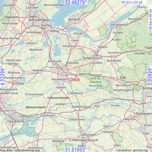
Odijk GPS coordinates[2]
52° 3' 9" North, 5° 14' 9.996" East
| Map corner | latitude | longitude |
|---|---|---|
| Upper-left | 52.48279°, | 4.53299° |
| Center: | 52.0525°, | 5.23611° |
| Lower-right: | 51.61803°, | 5.93924° |
| Map W x H: | 96.2×96.2 km | = 59.8×59.8mi |
| max Lat: | 53.48025° ⇑48.1% North |
| Odijk: | 52.0525° |
| min Lat: | ⇓51.9% South 50.76917° |
| min Long | Odijk | max Long |
| 3.38611° | 5.23611° | 7.16528° |
| W 34.5%⇐ | ⇒65.5% E |
Elevation
Elevation of Odijk is 3 m = 10 ft, and this is 12 m = 39 ft below average elevation for this country.
| Max E: |
203 m = 666 ft | 65.8% |
| Avg. | 15 m = 49 ft | |
| Odijk | 3 m = 10 ft | |
Min E: |
-6 m = -20 ft | 34.2% |
See also: Netherlands elevation on elevation.city.
Geographical zone
Odijk is located in North temperate zone (between Tropic of Cancer and the Arctic Circle). Distance of this North polar circle is 1613.5 km =1002.6 mi to North.| Distance of | km | miles | from Odijk |
|---|---|---|---|
| North Pole | 4219.4 | 2621.8 | to North |
| Arctic Circle | 1613.5 | 1002.6 | to North |
| Tropic Cancer | 3181.8 | 1977.1 | to South |
| Equator | 5787.7 | 3596.3 | to South |


Nearby cities:
15 places around Odijk: (largest is in red/bold)
• Austerlitz
6.2 km =3.9 mi,  60°
60°
• Bosch en Duin
7.1 km =4.4 mi,  3°
3°
• Bunnik
3 km =1.9 mi,  301°
301°
• Cothen
7.9 km =4.9 mi,  141°
141°
• De Bilt
7.4 km =4.6 mi,  329°
329°
• De Uithof
5.6 km =3.5 mi,  310°
310°
• Doorn
7.8 km =4.8 mi,  105°
105°
• Driebergen-Rijsenburg
3 km =1.9 mi,  88°
88°
• Houten
5.4 km =3.4 mi,  239°
239°
• Kerckebosch
3.5 km =2.2 mi,  35°
35°
• Lunetten
7 km =4.3 mi,  278°
278°
• Nijenheim
4 km =2.5 mi,  342°
342°
• Sterrenberg
7.5 km =4.7 mi,  24°
24°
• Werkhoven
3.1 km =1.9 mi,  169°
169°
• Zeist
4.2 km =2.6 mi,  357°
357°
Sources, notices
• [Note1] Compared only with cities in Netherlands existing in our database
• [Src1] Map data: © OpenStreetMap contributors (CC-BY-SA)
• [Src2] Other city data from geonames.org with taken over terms of usage.
• [Src3] Geographical zone / Annual Mean Temperature by Robert A. Rohde @ Wikipedia
