Sterrenberg geodata
Sterrenberg (Utrecht) is a populated place; located in Netherlands in Europe/Amsterdam (GMT+2) time zone. With population of 845 people, there are 1499 cities with bigger population in this country. Compared to other cities in Netherlands, 55.2% of cities are located further ↓South; 64.2% of cities are located further →East and 74.9% of cities have lower elevation than Sterrenberg. Note1


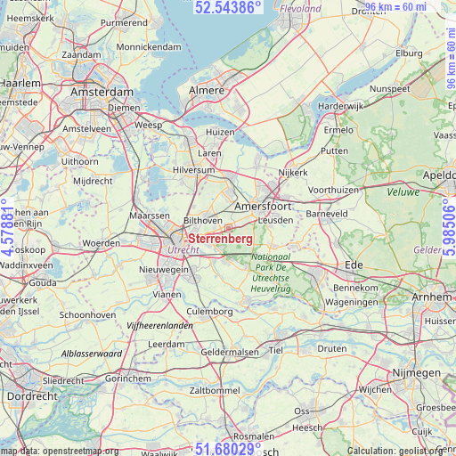
Sterrenberg GPS coordinates[2]
52° 6' 51.012" North, 5° 16' 54.984" East
| Map corner | latitude | longitude |
|---|---|---|
| Upper-left | 52.54386°, | 4.57881° |
| Center: | 52.11417°, | 5.28194° |
| Lower-right: | 51.68029°, | 5.98506° |
| Map W x H: | 96×96 km | = 59.7×59.7mi |
| max Lat: | 53.48025° ⇑44.8% North |
| Sterrenberg: | 52.11417° |
| min Lat: | ⇓55.2% South 50.76917° |
| min Long | Sterrenberg | max Long |
| 3.38611° | 5.28194° | 7.16528° |
| W 35.8%⇐ | ⇒64.2% E |
Elevation
Elevation of Sterrenberg is 18 m = 59 ft, and this is 3 m = 10 ft above average elevation for this country.
| Max E: |
203 m = 666 ft | 25.1% |
| Sterrenberg | 18 m 59 ft | |
| Avg. | 15 m = 49 ft | |
Min E: |
-6 m = -20 ft | 74.9% |
See also: Netherlands elevation on elevation.city.
Geographical zone
Sterrenberg is located in North temperate zone (between Tropic of Cancer and the Arctic Circle). Distance of this North polar circle is 1606.6 km =998.3 mi to North.| Distance of | km | miles | from Sterrenberg |
|---|---|---|---|
| North Pole | 4212.5 | 2617.5 | to North |
| Arctic Circle | 1606.6 | 998.3 | to North |
| Tropic Cancer | 3188.6 | 1981.3 | to South |
| Equator | 5794.6 | 3600.6 | to South |


Nearby cities:
15 places around Sterrenberg: (largest is in red/bold)
• Amersfoort
8.5 km =5.3 mi,  57°
57°
• Austerlitz
4.4 km =2.7 mi,  149°
149°
• Bosch en Duin
2.8 km =1.7 mi,  275°
275°
• Bunnik
7.8 km =4.8 mi,  227°
227°
• De Bilt
6.9 km =4.3 mi,  266°
266°
• De Uithof
8 km =5 mi,  246°
246°
• Driebergen-Rijsenburg
6.8 km =4.2 mi,  180°
180°
• Kerckebosch
4.1 km =2.5 mi,  195°
195°
• Maarn
8.2 km =5.1 mi,  132°
132°
• Maartensdijk
8.6 km =5.3 mi,  301°
301°
• Nijenheim
5.3 km =3.3 mi, 234°
• Odijk
7.5 km =4.7 mi, 204°
• Soest
6.6 km =4.1 mi,  5°
5°
• Soestdijk
8.5 km =5.3 mi,  1°
1°
• Zeist
4.3 km =2.7 mi, 231°
Sources, notices
• [Note1] Compared only with cities in Netherlands existing in our database
• [Src1] Map data: © OpenStreetMap contributors (CC-BY-SA)
• [Src2] Other city data from geonames.org with taken over terms of usage.
• [Src3] Geographical zone / Annual Mean Temperature by Robert A. Rohde @ Wikipedia
