Driebergen-Rijsenburg geodata
Driebergen-Rijsenburg (Utrecht) is a populated place; located in Netherlands in Europe/Amsterdam (GMT+2) time zone. With population of 18,553 people, there are 189 cities with bigger population in this country. Compared to other cities in Netherlands, 52% of cities are located further ↓South; 64.2% of cities are located further →East and 57.3% of cities have lower elevation than Driebergen-Rijsenburg. Note1
Current local time in Driebergen-Rijsenburg:
06:49 AM, ThursdayDifference from your time zone: hours


Driebergen-Rijsenburg GPS coordinates[2]
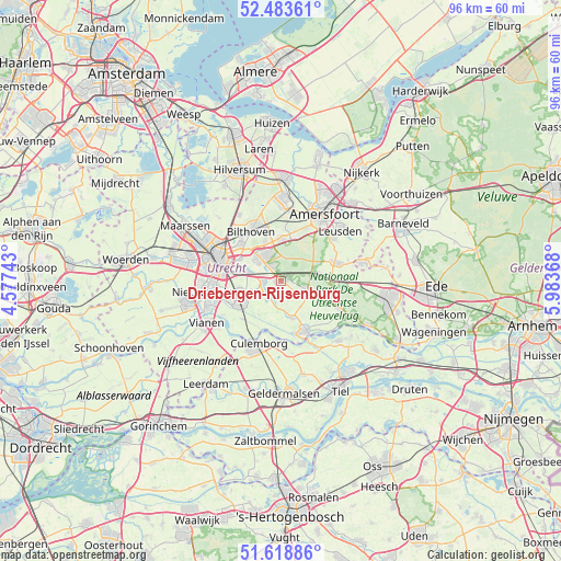
52° 3' 11.988" North, 5° 16' 50.016" East
| Map corner | latitude | longitude |
|---|---|---|
| Upper-left | 52.48361°, | 4.57743° |
| Center: | 52.05333°, | 5.28056° |
| Lower-right: | 51.61886°, | 5.98368° |
| Map W x H: | 96.2×96.1 km | = 59.8×59.7mi |
| max Lat: | 53.48025° ⇑48% North |
| Driebergen-Rijsenburg: | 52.05333° |
| min Lat: | ⇓52% South 50.76917° |
| min Long | Driebergen-Rijs | max Long |
| 3.38611° | 5.28056° | 7.16528° |
| W 35.8%⇐ | ⇒64.2% E |
Elevation
Elevation of Driebergen-Rijsenburg is 9 m = 30 ft, and this is 6 m = 20 ft below average elevation for this country.
| Max E: |
203 m = 666 ft | 42.7% |
| Avg. | 15 m = 49 ft | |
| Driebergen-Rijsenburg | 9 m = 30 ft | |
Min E: |
-6 m = -20 ft | 57.3% |
See also: Netherlands elevation on elevation.city.
Geographical zone
Driebergen-Rijsenburg is located in North temperate zone (between Tropic of Cancer and the Arctic Circle). Distance of this North polar circle is 1613.4 km =1002.5 mi to North.| Distance of | km | miles | from Driebergen-Rijsenburg |
|---|---|---|---|
| North Pole | 4219.3 | 2621.8 | to North |
| Arctic Circle | 1613.4 | 1002.5 | to North |
| Tropic Cancer | 3181.9 | 1977.1 | to South |
| Equator | 5787.8 | 3596.4 | to South |


Nearby cities:
15 places around Driebergen-Rijsenburg: (largest is in red/bold)
• Austerlitz
3.8 km =2.4 mi,  38°
38°
• Bosch en Duin
7.5 km =4.7 mi,  339°
339°
• Bunnik
5.8 km =3.6 mi,  284°
284°
• Cothen
6.6 km =4.1 mi,  163°
163°
• De Uithof
8.1 km =5 mi,  296°
296°
• Doorn
5 km =3.1 mi,  116°
116°
• Houten
8.2 km =5.1 mi,  250°
250°
• Kerckebosch
3 km =1.9 mi, 340°
• Maarn
6.3 km =3.9 mi,  78°
78°
• Maarsbergen
8.6 km =5.3 mi,  86°
86°
• Nijenheim
5.6 km =3.5 mi,  311°
311°
• Odijk
3 km =1.9 mi,  268°
268°
• Sterrenberg
6.8 km =4.2 mi,  0°
0°
• Werkhoven
4 km =2.5 mi,  218°
218°
• Zeist
5.2 km =3.2 mi,  321°
321°
Sources, notices
• [Note1] Compared only with cities in Netherlands existing in our database
• [Src1] Map data: © OpenStreetMap contributors (CC-BY-SA)
• [Src2] Other city data from geonames.org with taken over terms of usage.
• [Src3] Geographical zone / Annual Mean Temperature by Robert A. Rohde @ Wikipedia
