Magele geodata
Magele (Overijssel) is a populated place; located in Netherlands in Europe/Amsterdam (GMT+2) time zone. With population of 1,020 people, there are 1386 cities with bigger population in this country. Compared to other cities in Netherlands, 70.9% of cities are located further ↓South; 89.2% of cities are located further ←West and 50.6% of cities have higher elevation than Magele. Note1


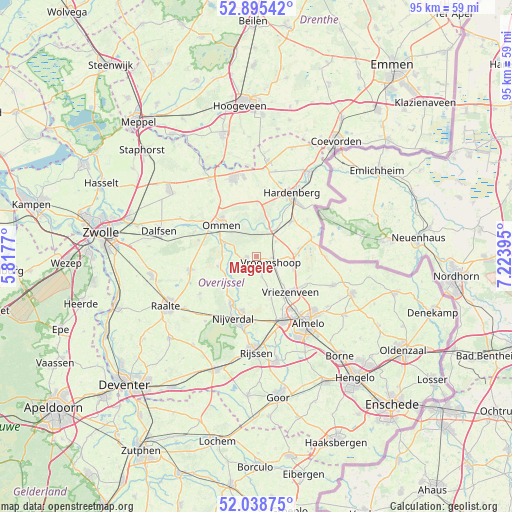
Magele GPS coordinates[2]
52° 28' 9.012" North, 6° 31' 14.988" East
| Map corner | latitude | longitude |
|---|---|---|
| Upper-left | 52.89542°, | 5.8177° |
| Center: | 52.46917°, | 6.52083° |
| Lower-right: | 52.03875°, | 7.22395° |
| Map W x H: | 95.3×95.3 km | = 59.2×59.2mi |
| max Lat: | 53.48025° ⇑29.1% North |
| Magele: | 52.46917° |
| min Lat: | ⇓70.9% South 50.76917° |
| min Long | Magele | max Long |
| 3.38611° | 6.52083° | 7.16528° |
| W 89.2%⇐ | ⇒10.8% E |
Elevation
Elevation of Magele is 6 m = 20 ft, and this is 9 m = 30 ft below average elevation for this country.
| Max E: |
203 m = 666 ft | 50.6% |
| Avg. | 15 m = 49 ft | |
| Magele | 6 m = 20 ft | |
Min E: |
-6 m = -20 ft | 49.4% |
See also: Netherlands elevation on elevation.city.
Geographical zone
Magele is located in North temperate zone (between Tropic of Cancer and the Arctic Circle). Distance of this North polar circle is 1567.1 km =973.8 mi to North.| Distance of | km | miles | from Magele |
|---|---|---|---|
| North Pole | 4173 | 2593 | to North |
| Arctic Circle | 1567.1 | 973.8 | to North |
| Tropic Cancer | 3228.1 | 2005.8 | to South |
| Equator | 5834 | 3625.1 | to South |


Nearby cities:
15 places around Magele: (largest is in red/bold)
• Baalder
15.8 km =9.8 mi,  34°
34°
• Daarle
4.1 km =2.5 mi,  163°
163°
• Den Ham
1.7 km =1.1 mi,  257°
257°
• Haarle
15.5 km =9.6 mi,  217°
217°
• Hardenberg
13.6 km =8.5 mi, 29°
• Hellendoorn
10.1 km =6.3 mi,  207°
207°
• Hulsen
10.5 km =6.5 mi,  197°
197°
• Marle
5.7 km =3.5 mi, 208°
• Nieuwoord
2 km =1.2 mi,  98°
98°
• Ommen
8.9 km =5.5 mi,  310°
310°
• Rheezerveen
10.8 km =6.7 mi,  1°
1°
• Vriezenveen
9.6 km =6 mi,  134°
134°
• Vroomshoop
3.2 km =2 mi,  107°
107°
• Westerhaar-Vriezenveensewijk
7.1 km =4.4 mi, 102°
• Wierden
13.2 km =8.2 mi, 158°
Sources, notices
• [Note1] Compared only with cities in Netherlands existing in our database
• [Src1] Map data: © OpenStreetMap contributors (CC-BY-SA)
• [Src2] Other city data from geonames.org with taken over terms of usage.
• [Src3] Geographical zone / Annual Mean Temperature by Robert A. Rohde @ Wikipedia
