Hulsen geodata
Hulsen (Overijssel) is a populated place; located in Netherlands in Europe/Amsterdam (GMT+2) time zone. With population of 680 people, there are 1644 cities with bigger population in this country. Compared to other cities in Netherlands, 68.6% of cities are located further ↓South; 88.3% of cities are located further ←West and 59.4% of cities have lower elevation than Hulsen. Note1


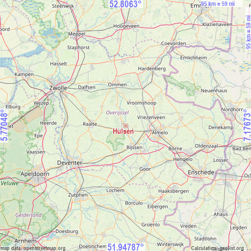
Hulsen GPS coordinates[2]
52° 22' 45.012" North, 6° 28' 24.996" East
| Map corner | latitude | longitude |
|---|---|---|
| Upper-left | 52.8063°, | 5.77048° |
| Center: | 52.37917°, | 6.47361° |
| Lower-right: | 51.94787°, | 7.17673° |
| Map W x H: | 95.4×95.4 km | = 59.3×59.3mi |
| max Lat: | 53.48025° ⇑31.4% North |
| Hulsen: | 52.37917° |
| min Lat: | ⇓68.6% South 50.76917° |
| min Long | Hulsen | max Long |
| 3.38611° | 6.47361° | 7.16528° |
| W 88.3%⇐ | ⇒11.7% E |
Elevation
Elevation of Hulsen is 10 m = 33 ft, and this is 5 m = 16 ft below average elevation for this country.
| Max E: |
203 m = 666 ft | 40.6% |
| Avg. | 15 m = 49 ft | |
| Hulsen | 10 m = 33 ft | |
Min E: |
-6 m = -20 ft | 59.4% |
See also: Netherlands elevation on elevation.city.
Geographical zone
Hulsen is located in North temperate zone (between Tropic of Cancer and the Arctic Circle). Distance of this North polar circle is 1577.2 km =980 mi to North.| Distance of | km | miles | from Hulsen |
|---|---|---|---|
| North Pole | 4183 | 2599.2 | to North |
| Arctic Circle | 1577.2 | 980 | to North |
| Tropic Cancer | 3218.1 | 1999.6 | to South |
| Equator | 5824 | 3618.9 | to South |


Nearby cities:
15 places around Hulsen: (largest is in red/bold)
• Almelo
13.1 km =8.1 mi,  101°
101°
• Daarle
7.5 km =4.7 mi,  35°
35°
• Den Ham
9.8 km =6.1 mi,  8°
8°
• Elsen
12.9 km =8 mi,  159°
159°
• Haarle
6.7 km =4.2 mi,  250°
250°
• Hellendoorn
1.8 km =1.1 mi,  304°
304°
• Magele
10.5 km =6.5 mi,  17°
17°
• Marle
5 km =3.1 mi, 5°
• Nieuwoord
11 km =6.8 mi,  28°
28°
• Nijrees
13.8 km =8.6 mi,  110°
110°
• Raalte
13.5 km =8.4 mi,  273°
273°
• Vriezenveen
10.6 km =6.6 mi,  72°
72°
• Vroomshoop
11 km =6.8 mi, 34°
• Westerhaar-Vriezenveensewijk
13.3 km =8.3 mi,  50°
50°
• Wierden
8.4 km =5.2 mi, 105°
Sources, notices
• [Note1] Compared only with cities in Netherlands existing in our database
• [Src1] Map data: © OpenStreetMap contributors (CC-BY-SA)
• [Src2] Other city data from geonames.org with taken over terms of usage.
• [Src3] Geographical zone / Annual Mean Temperature by Robert A. Rohde @ Wikipedia
