Loil geodata
Loil (Gelderland) is a populated place; located in Netherlands in Europe/Amsterdam (GMT+2) time zone. With population of 840 people, there are 1501 cities with bigger population in this country. Compared to other cities in Netherlands, 54.2% of cities are located further ↑North; 81.3% of cities are located further ←West and 64.6% of cities have lower elevation than Loil. Note1


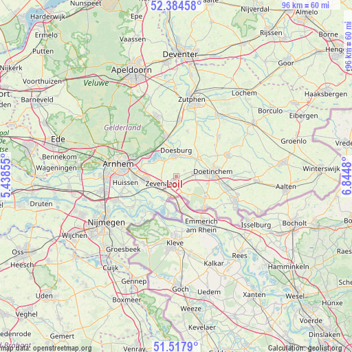
Loil GPS coordinates[2]
51° 57' 11.988" North, 6° 8' 30.012" East
| Map corner | latitude | longitude |
|---|---|---|
| Upper-left | 52.38458°, | 5.43855° |
| Center: | 51.95333°, | 6.14167° |
| Lower-right: | 51.5179°, | 6.8448° |
| Map W x H: | 96.4×96.4 km | = 59.9×59.9mi |
| max Lat: | 53.48025° ⇑54.2% North |
| Loil: | 51.95333° |
| min Lat: | ⇓45.8% South 50.76917° |
| min Long | Loil | max Long |
| 3.38611° | 6.14167° | 7.16528° |
| W 81.3%⇐ | ⇒18.7% E |
Elevation
Elevation of Loil is 12 m = 39 ft, and this is 3 m = 10 ft below average elevation for this country.
| Max E: |
203 m = 666 ft | 35.4% |
| Avg. | 15 m = 49 ft | |
| Loil | 12 m = 39 ft | |
Min E: |
-6 m = -20 ft | 64.6% |
See also: Netherlands elevation on elevation.city.
Geographical zone
Loil is located in North temperate zone (between Tropic of Cancer and the Arctic Circle). Distance of this North polar circle is 1624.5 km =1009.4 mi to North.| Distance of | km | miles | from Loil |
|---|---|---|---|
| North Pole | 4230.4 | 2628.6 | to North |
| Arctic Circle | 1624.5 | 1009.4 | to North |
| Tropic Cancer | 3170.7 | 1970.2 | to South |
| Equator | 5776.7 | 3589.5 | to South |


Nearby cities:
15 places around Loil: (largest is in red/bold)
• Aerdt
7.6 km =4.7 mi,  210°
210°
• Angerlo
4.7 km =2.9 mi,  354°
354°
• Babberich
5.5 km =3.4 mi,  202°
202°
• Beek gem Montferland
6.1 km =3.8 mi,  148°
148°
• Doesburg
6.6 km =4.1 mi,  358°
358°
• Drempt
6.4 km =4 mi,  20°
20°
• Giesbeek
6.8 km =4.2 mi,  310°
310°
• Groessen
8.3 km =5.2 mi,  253°
253°
• Herwen
8.1 km =5 mi, 200°
• Kilder
6.4 km =4 mi,  105°
105°
• Nieuw-Dijk
2.4 km =1.5 mi,  156°
156°
• Ooy
6.9 km =4.3 mi,  236°
236°
• Stegeslag
5.6 km =3.5 mi,  256°
256°
• Zevenaar
5.5 km =3.4 mi, 241°
• Zonnemaat
6 km =3.7 mi, 245°
Sources, notices
• [Note1] Compared only with cities in Netherlands existing in our database
• [Src1] Map data: © OpenStreetMap contributors (CC-BY-SA)
• [Src2] Other city data from geonames.org with taken over terms of usage.
• [Src3] Geographical zone / Annual Mean Temperature by Robert A. Rohde @ Wikipedia
