Lemiers geodata
Lemiers (Limburg) is a populated place; located in Netherlands in Europe/Amsterdam (GMT+2) time zone. With population of 720 people, there are 1602 cities with bigger population in this country. Compared to other cities in Netherlands, 99.7% of cities are located further ↑North; 72.3% of cities are located further ←West and 99.2% of cities have lower elevation than Lemiers. Note1


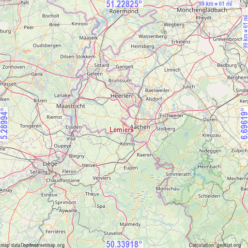
Lemiers GPS coordinates[2]
50° 47' 8.988" North, 5° 59' 35.016" East
| Map corner | latitude | longitude |
|---|---|---|
| Upper-left | 51.22825°, | 5.28994° |
| Center: | 50.78583°, | 5.99306° |
| Lower-right: | 50.33918°, | 6.69619° |
| Map W x H: | 98.9×98.9 km | = 61.5×61.5mi |
| max Lat: | 53.48025° ⇑99.7% North |
| Lemiers: | 50.78583° |
| min Lat: | ⇓0.3% South 50.76917° |
| min Long | Lemiers | max Long |
| 3.38611° | 5.99306° | 7.16528° |
| W 72.3%⇐ | ⇒27.7% E |
Elevation
Elevation of Lemiers is 157 m = 515 ft, and this is 142 m = 466 ft above average elevation for this country.
| Max E: |
203 m = 666 ft | 0.8% |
| Lemiers | 157 m 515 ft | |
| Avg. | 15 m = 49 ft | |
Min E: |
-6 m = -20 ft | 99.2% |
See also: Netherlands elevation on elevation.city.
Geographical zone
Lemiers is located in North temperate zone (between Tropic of Cancer and the Arctic Circle). Distance of this North polar circle is 1754.3 km =1090.1 mi to North.| Distance of | km | miles | from Lemiers |
|---|---|---|---|
| North Pole | 4360.2 | 2709.3 | to North |
| Arctic Circle | 1754.3 | 1090.1 | to North |
| Tropic Cancer | 3040.9 | 1889.5 | to South |
| Equator | 5646.9 | 3508.8 | to South |


Nearby cities:
15 places around Lemiers: (largest is in red/bold)
• Bocholtz
3.7 km =2.3 mi,  13°
13°
• Bocholtzerheide
3.3 km =2.1 mi,  356°
356°
• Epen
5.9 km =3.7 mi,  259°
259°
• Gracht
7.7 km =4.8 mi,  18°
18°
• Gulpen
8 km =5 mi,  294°
294°
• Kaalheide
9.3 km =5.8 mi, 19°
• Mechelen
4.8 km =3 mi,  283°
283°
• Nijswiller
3.6 km =2.2 mi,  315°
315°
• Simpelveld
5.4 km =3.4 mi,  351°
351°
• Spekholzerheide
8.1 km =5 mi, 15°
• Terwinselen
9.3 km =5.8 mi, 13°
• Ubachsberg
8.1 km =5 mi,  337°
337°
• Vaals
2.4 km =1.5 mi,  133°
133°
• Vijlen
2 km =1.2 mi, 278°
• Wijlre
8.6 km =5.3 mi,  307°
307°
Sources, notices
• [Note1] Compared only with cities in Netherlands existing in our database
• [Src1] Map data: © OpenStreetMap contributors (CC-BY-SA)
• [Src2] Other city data from geonames.org with taken over terms of usage.
• [Src3] Geographical zone / Annual Mean Temperature by Robert A. Rohde @ Wikipedia
