Gracht geodata
Gracht (Limburg) is a populated place; located in Netherlands in Europe/Amsterdam (GMT+2) time zone. With population of 2,080 people, there are 940 cities with bigger population in this country. Compared to other cities in Netherlands, 98.3% of cities are located further ↑North; 74.6% of cities are located further ←West and 99.3% of cities have lower elevation than Gracht. Note1


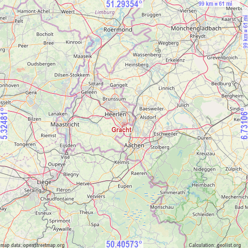
Gracht GPS coordinates[2]
50° 51' 6.3" North, 6° 1' 40.548" East
| Map corner | latitude | longitude |
|---|---|---|
| Upper-left | 51.29354°, | 5.32481° |
| Center: | 50.85175°, | 6.02793° |
| Lower-right: | 50.40573°, | 6.73106° |
| Map W x H: | 98.7×98.7 km | = 61.3×61.3mi |
| max Lat: | 53.48025° ⇑98.3% North |
| Gracht: | 50.85175° |
| min Lat: | ⇓1.7% South 50.76917° |
| min Long | Gracht | max Long |
| 3.38611° | 6.02793° | 7.16528° |
| W 74.6%⇐ | ⇒25.4% E |
Elevation
Elevation of Gracht is 160 m = 525 ft, and this is 145 m = 476 ft above average elevation for this country.
| Max E: |
203 m = 666 ft | 0.7% |
| Gracht | 160 m 525 ft | |
| Avg. | 15 m = 49 ft | |
Min E: |
-6 m = -20 ft | 99.3% |
See also: Netherlands elevation on elevation.city.
Geographical zone
Gracht is located in North temperate zone (between Tropic of Cancer and the Arctic Circle). Distance of this North polar circle is 1747 km =1085.5 mi to North.| Distance of | km | miles | from Gracht |
|---|---|---|---|
| North Pole | 4352.9 | 2704.8 | to North |
| Arctic Circle | 1747 | 1085.5 | to North |
| Tropic Cancer | 3048.3 | 1894.1 | to South |
| Equator | 5654.2 | 3513.4 | to South |


Nearby cities:
15 places around Gracht: (largest is in red/bold)
• Bleijerheide
2.8 km =1.7 mi,  81°
81°
• Bocholtz
4 km =2.5 mi,  202°
202°
• Bocholtzerheide
4.8 km =3 mi,  213°
213°
• Chevremont
3.5 km =2.2 mi,  40°
40°
• Haanrade
4.5 km =2.8 mi,  46°
46°
• Heerlen
4.8 km =3 mi,  317°
317°
• Holz
3.5 km =2.2 mi,  67°
67°
• Hopel
4.8 km =3 mi,  19°
19°
• Kaalheide
1.6 km =1 mi, 21°
• Kerkrade
2.9 km =1.8 mi,  57°
57°
• Lichtenberg
5.6 km =3.5 mi,  358°
358°
• Simpelveld
3.8 km =2.4 mi,  238°
238°
• Spekholzerheide
0.5 km =0.3 mi,  332°
332°
• Terwinselen
1.7 km =1.1 mi,  352°
352°
• Ubachsberg
5.6 km =3.5 mi,  271°
271°
Sources, notices
• [Note1] Compared only with cities in Netherlands existing in our database
• [Src1] Map data: © OpenStreetMap contributors (CC-BY-SA)
• [Src2] Other city data from geonames.org with taken over terms of usage.
• [Src3] Geographical zone / Annual Mean Temperature by Robert A. Rohde @ Wikipedia
