Terschuur geodata
Terschuur (Gelderland) is a populated place; located in Netherlands in Europe/Amsterdam (GMT+2) time zone. With population of 1,480 people, there are 1144 cities with bigger population in this country. Compared to other cities in Netherlands, 57.9% of cities are located further ↓South; 56.1% of cities are located further →East and 50.6% of cities have higher elevation than Terschuur. Note1


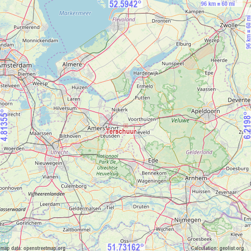
Terschuur GPS coordinates[2]
52° 9' 54" North, 5° 31' 0.012" East
| Map corner | latitude | longitude |
|---|---|---|
| Upper-left | 52.5942°, | 4.81355° |
| Center: | 52.165°, | 5.51667° |
| Lower-right: | 51.73162°, | 6.2198° |
| Map W x H: | 95.9×95.9 km | = 59.6×59.6mi |
| max Lat: | 53.48025° ⇑42.1% North |
| Terschuur: | 52.165° |
| min Lat: | ⇓57.9% South 50.76917° |
| min Long | Terschuur | max Long |
| 3.38611° | 5.51667° | 7.16528° |
| W 43.9%⇐ | ⇒56.1% E |
Elevation
Elevation of Terschuur is 6 m = 20 ft, and this is 9 m = 30 ft below average elevation for this country.
| Max E: |
203 m = 666 ft | 50.6% |
| Avg. | 15 m = 49 ft | |
| Terschuur | 6 m = 20 ft | |
Min E: |
-6 m = -20 ft | 49.4% |
See also: Netherlands elevation on elevation.city.
Geographical zone
Terschuur is located in North temperate zone (between Tropic of Cancer and the Arctic Circle). Distance of this North polar circle is 1601 km =994.8 mi to North.| Distance of | km | miles | from Terschuur |
|---|---|---|---|
| North Pole | 4206.9 | 2614 | to North |
| Arctic Circle | 1601 | 994.8 | to North |
| Tropic Cancer | 3194.3 | 1984.8 | to South |
| Equator | 5800.2 | 3604.1 | to South |


Nearby cities:
15 places around Terschuur: (largest is in red/bold)
• Amersfoort
8.9 km =5.5 mi,  262°
262°
• Appel
3 km =1.9 mi,  32°
32°
• Barneveld
5.4 km =3.4 mi,  120°
120°
• Corlaer
6.7 km =4.2 mi,  328°
328°
• Doornsteeg
8.4 km =5.2 mi, 329°
• Hoogland
9.9 km =6.2 mi,  281°
281°
• Langenoord
9.6 km =6 mi,  285°
285°
• Leusden
6.8 km =4.2 mi,  237°
237°
• Nederwoud
8 km =5 mi,  152°
152°
• Nijkerk
6.5 km =4 mi,  341°
341°
• Nijkerkerveen
4.8 km =3 mi,  314°
314°
• Randenbroek
8.1 km =5 mi, 256°
• Scherpenzeel
9.6 km =6 mi,  191°
191°
• Voorthuizen
6.5 km =4 mi,  68°
68°
• Zwartebroek
1.8 km =1.1 mi, 331°
Sources, notices
• [Note1] Compared only with cities in Netherlands existing in our database
• [Src1] Map data: © OpenStreetMap contributors (CC-BY-SA)
• [Src2] Other city data from geonames.org with taken over terms of usage.
• [Src3] Geographical zone / Annual Mean Temperature by Robert A. Rohde @ Wikipedia
