Klein-Zundert geodata
Klein-Zundert (North Brabant) is a populated place; located in Netherlands in Europe/Amsterdam (GMT+2) time zone. With population of 1,320 people, there are 1227 cities with bigger population in this country. Compared to other cities in Netherlands, 82.4% of cities are located further ↑North; 84.8% of cities are located further →East and 59.4% of cities have lower elevation than Klein-Zundert. Note1


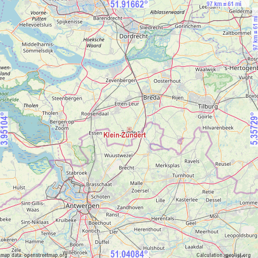
Klein-Zundert GPS coordinates[2]
51° 28' 50.988" North, 4° 39' 15.012" East
| Map corner | latitude | longitude |
|---|---|---|
| Upper-left | 51.91662°, | 3.95104° |
| Center: | 51.48083°, | 4.65417° |
| Lower-right: | 51.04084°, | 5.35729° |
| Map W x H: | 97.4×97.4 km | = 60.5×60.5mi |
| max Lat: | 53.48025° ⇑82.4% North |
| Klein-Zundert: | 51.48083° |
| min Lat: | ⇓17.6% South 50.76917° |
| min Long | Klein-Zundert | max Long |
| 3.38611° | 4.65417° | 7.16528° |
| W 15.2%⇐ | ⇒84.8% E |
Elevation
Elevation of Klein-Zundert is 10 m = 33 ft, and this is 5 m = 16 ft below average elevation for this country.
| Max E: |
203 m = 666 ft | 40.6% |
| Avg. | 15 m = 49 ft | |
| Klein-Zundert | 10 m = 33 ft | |
Min E: |
-6 m = -20 ft | 59.4% |
See also: Netherlands elevation on elevation.city.
Geographical zone
Klein-Zundert is located in North temperate zone (between Tropic of Cancer and the Arctic Circle). Distance of this North polar circle is 1677 km =1042 mi to North.| Distance of | km | miles | from Klein-Zundert |
|---|---|---|---|
| North Pole | 4282.9 | 2661.3 | to North |
| Arctic Circle | 1677 | 1042 | to North |
| Tropic Cancer | 3118.2 | 1937.6 | to South |
| Equator | 5724.1 | 3556.8 | to South |


Nearby cities:
15 places around Klein-Zundert: (largest is in red/bold)
• Achtmaal
5.7 km =3.5 mi,  238°
238°
• Bosschenhoofd
11.9 km =7.4 mi,  318°
318°
• Galder
9.3 km =5.8 mi,  65°
65°
• Hoeven
12 km =7.5 mi,  335°
335°
• Nispen
13.4 km =8.3 mi,  271°
271°
• Princenhage
12.1 km =7.5 mi,  28°
28°
• Rijsbergen
5.1 km =3.2 mi,  36°
36°
• Rucphen
8.7 km =5.4 mi,  310°
310°
• Schijf
6.8 km =4.2 mi,  287°
287°
• Sint Willebrord
8.8 km =5.5 mi,  328°
328°
• Sprundel
7.4 km =4.6 mi, 327°
• Ulvenhout
12.6 km =7.8 mi,  52°
52°
• Wernhout
3 km =1.9 mi,  196°
196°
• Zegge
12.6 km =7.8 mi, 311°
• Zundert
1 km =0.6 mi,  174°
174°
Sources, notices
• [Note1] Compared only with cities in Netherlands existing in our database
• [Src1] Map data: © OpenStreetMap contributors (CC-BY-SA)
• [Src2] Other city data from geonames.org with taken over terms of usage.
• [Src3] Geographical zone / Annual Mean Temperature by Robert A. Rohde @ Wikipedia
