Hoeven geodata
Hoeven (North Brabant) is a populated place; located in Netherlands in Europe/Amsterdam (GMT+2) time zone. With population of 4,895 people, there are 497 cities with bigger population in this country. Compared to other cities in Netherlands, 75.1% of cities are located further ↑North; 87% of cities are located further →East and 54.1% of cities have higher elevation than Hoeven. Note1


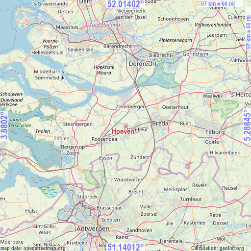
Hoeven GPS coordinates[2]
51° 34' 45.012" North, 4° 34' 59.988" East
| Map corner | latitude | longitude |
|---|---|---|
| Upper-left | 52.01402°, | 3.8802° |
| Center: | 51.57917°, | 4.58333° |
| Lower-right: | 51.14012°, | 5.28645° |
| Map W x H: | 97.2×97.2 km | = 60.4×60.4mi |
| max Lat: | 53.48025° ⇑75.1% North |
| Hoeven: | 51.57917° |
| min Lat: | ⇓24.9% South 50.76917° |
| min Long | Hoeven | max Long |
| 3.38611° | 4.58333° | 7.16528° |
| W 13%⇐ | ⇒87% E |
Elevation
Elevation of Hoeven is 5 m = 16 ft, and this is 10 m = 33 ft below average elevation for this country.
| Max E: |
203 m = 666 ft | 54.1% |
| Avg. | 15 m = 49 ft | |
| Hoeven | 5 m = 16 ft | |
Min E: |
-6 m = -20 ft | 45.9% |
See also: Netherlands elevation on elevation.city.
Geographical zone
Hoeven is located in North temperate zone (between Tropic of Cancer and the Arctic Circle). Distance of this North polar circle is 1666.1 km =1035.3 mi to North.| Distance of | km | miles | from Hoeven |
|---|---|---|---|
| North Pole | 4272 | 2654.5 | to North |
| Arctic Circle | 1666.1 | 1035.3 | to North |
| Tropic Cancer | 3129.1 | 1944.3 | to South |
| Equator | 5735.1 | 3563.6 | to South |


Nearby cities:
15 places around Hoeven: (largest is in red/bold)
• Bosschenhoofd
3.6 km =2.2 mi,  235°
235°
• Kalsdonk
8.9 km =5.5 mi, 240°
• Krooswijk
7.5 km =4.7 mi,  4°
4°
• Langeweg
9.5 km =5.9 mi,  36°
36°
• Noordhoek
7.9 km =4.9 mi,  333°
333°
• Oud Gastel
8.6 km =5.3 mi,  275°
275°
• Prinsenbeek
9.2 km =5.7 mi,  76°
76°
• Roosendaal
9.8 km =6.1 mi, 236°
• Rucphen
5.6 km =3.5 mi,  198°
198°
• Schijf
9 km =5.6 mi,  189°
189°
• Sint Willebrord
3.5 km =2.2 mi,  173°
173°
• Sprundel
4.7 km =2.9 mi, 168°
• Standdaarbuiten
6.1 km =3.8 mi,  308°
308°
• Stoof
7.6 km =4.7 mi,  286°
286°
• Zegge
5.2 km =3.2 mi, 240°
Sources, notices
• [Note1] Compared only with cities in Netherlands existing in our database
• [Src1] Map data: © OpenStreetMap contributors (CC-BY-SA)
• [Src2] Other city data from geonames.org with taken over terms of usage.
• [Src3] Geographical zone / Annual Mean Temperature by Robert A. Rohde @ Wikipedia
