Jagershoef geodata
Jagershoef (North Brabant) is a section of populated place; located in Netherlands in Europe/Amsterdam (GMT+2) time zone. With population of 3,560 people, there are 661 cities with bigger population in this country. Compared to other cities in Netherlands, 82.6% of cities are located further ↑North; 58% of cities are located further →East and 74.9% of cities have lower elevation than Jagershoef. Note1


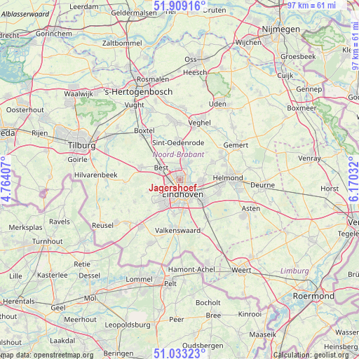
Jagershoef GPS coordinates[2]
51° 28' 23.88" North, 5° 28' 1.92" East
| Map corner | latitude | longitude |
|---|---|---|
| Upper-left | 51.90916°, | 4.76407° |
| Center: | 51.4733°, | 5.4672° |
| Lower-right: | 51.03323°, | 6.17032° |
| Map W x H: | 97.4×97.4 km | = 60.5×60.5mi |
| max Lat: | 53.48025° ⇑82.6% North |
| Jagershoef: | 51.4733° |
| min Lat: | ⇓17.4% South 50.76917° |
| min Long | Jagershoef | max Long |
| 3.38611° | 5.4672° | 7.16528° |
| W 42%⇐ | ⇒58% E |
Elevation
Elevation of Jagershoef is 18 m = 59 ft, and this is 3 m = 10 ft above average elevation for this country.
| Max E: |
203 m = 666 ft | 25.1% |
| Jagershoef | 18 m 59 ft | |
| Avg. | 15 m = 49 ft | |
Min E: |
-6 m = -20 ft | 74.9% |
See also: Netherlands elevation on elevation.city.
Geographical zone
Jagershoef is located in North temperate zone (between Tropic of Cancer and the Arctic Circle). Distance of this North polar circle is 1677.9 km =1042.6 mi to North.| Distance of | km | miles | from Jagershoef |
|---|---|---|---|
| North Pole | 4283.8 | 2661.8 | to North |
| Arctic Circle | 1677.9 | 1042.6 | to North |
| Tropic Cancer | 3117.4 | 1937.1 | to South |
| Equator | 5723.3 | 3556.3 | to South |


Nearby cities:
15 places around Jagershoef: (largest is in red/bold)
• 't Hofke
4.5 km =2.8 mi,  126°
126°
• Batadorp
5 km =3.1 mi,  290°
290°
• De Doornakkers
4.8 km =3 mi,  143°
143°
• Eckart
1.9 km =1.2 mi,  90°
90°
• Eindhoven
3.7 km =2.3 mi,  168°
168°
• Heesterakker
2.5 km =1.6 mi,  55°
55°
• Lakerlopen
4.6 km =2.9 mi,  149°
149°
• Lievendaal
4.2 km =2.6 mi,  213°
213°
• Nederwetten
4.4 km =2.7 mi, 62°
• Son
4.6 km =2.9 mi,  22°
22°
• Tongelre
4.5 km =2.8 mi, 126°
• Vaartbroek
2.2 km =1.4 mi,  72°
72°
• Villapark
4 km =2.5 mi, 152°
• Vlokhoven
1.3 km =0.8 mi,  123°
123°
• Woenselse Heide
1.1 km =0.7 mi,  358°
358°
Sources, notices
• [Note1] Compared only with cities in Netherlands existing in our database
• [Src1] Map data: © OpenStreetMap contributors (CC-BY-SA)
• [Src2] Other city data from geonames.org with taken over terms of usage.
• [Src3] Geographical zone / Annual Mean Temperature by Robert A. Rohde @ Wikipedia
