Batadorp geodata
Batadorp (North Brabant) is a section of populated place; located in Netherlands in Europe/Amsterdam (GMT+2) time zone. With population of 515 people, there are 1818 cities with bigger population in this country. Compared to other cities in Netherlands, 81.6% of cities are located further ↑North; 60.7% of cities are located further →East and 78.8% of cities have lower elevation than Batadorp. Note1


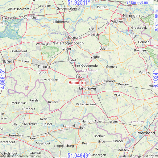
Batadorp GPS coordinates[2]
51° 29' 21.84" North, 5° 23' 57.372" East
| Map corner | latitude | longitude |
|---|---|---|
| Upper-left | 51.92511°, | 4.69615° |
| Center: | 51.4894°, | 5.39927° |
| Lower-right: | 51.04949°, | 6.1024° |
| Map W x H: | 97.4×97.4 km | = 60.5×60.5mi |
| max Lat: | 53.48025° ⇑81.6% North |
| Batadorp: | 51.4894° |
| min Lat: | ⇓18.4% South 50.76917° |
| min Long | Batadorp | max Long |
| 3.38611° | 5.39927° | 7.16528° |
| W 39.3%⇐ | ⇒60.7% E |
Elevation
Elevation of Batadorp is 20 m = 66 ft, and this is 5 m = 16 ft above average elevation for this country.
| Max E: |
203 m = 666 ft | 21.2% |
| Batadorp | 20 m 66 ft | |
| Avg. | 15 m = 49 ft | |
Min E: |
-6 m = -20 ft | 78.8% |
See also: Netherlands elevation on elevation.city.
Geographical zone
Batadorp is located in North temperate zone (between Tropic of Cancer and the Arctic Circle). Distance of this North polar circle is 1676.1 km =1041.5 mi to North.| Distance of | km | miles | from Batadorp |
|---|---|---|---|
| North Pole | 4282 | 2660.7 | to North |
| Arctic Circle | 1676.1 | 1041.5 | to North |
| Tropic Cancer | 3119.2 | 1938.2 | to South |
| Equator | 5725.1 | 3557.4 | to South |


Nearby cities:
15 places around Batadorp: (largest is in red/bold)
• Best
2.1 km =1.3 mi,  342°
342°
• Boskant
6.9 km =4.3 mi,  12°
12°
• Eckart
6.8 km =4.2 mi,  105°
105°
• Grasrijk
5.7 km =3.5 mi,  168°
168°
• Heesterakker
6.8 km =4.2 mi,  93°
93°
• Jagershoef
5 km =3.1 mi, 110°
• Lievendaal
5.8 km =3.6 mi,  155°
155°
• Meerhoven
5.3 km =3.3 mi, 171°
• Naastenbest
2 km =1.2 mi,  331°
331°
• Oirschot
6.2 km =3.9 mi,  286°
286°
• Salderes
2.9 km =1.8 mi,  347°
347°
• Speelheide
1.9 km =1.2 mi, 12°
• Vlokhoven
6.3 km =3.9 mi, 113°
• Wilhelminadorp
1 km =0.6 mi, 331°
• Woenselse Heide
4.7 km =2.9 mi,  98°
98°
Sources, notices
• [Note1] Compared only with cities in Netherlands existing in our database
• [Src1] Map data: © OpenStreetMap contributors (CC-BY-SA)
• [Src2] Other city data from geonames.org with taken over terms of usage.
• [Src3] Geographical zone / Annual Mean Temperature by Robert A. Rohde @ Wikipedia
